

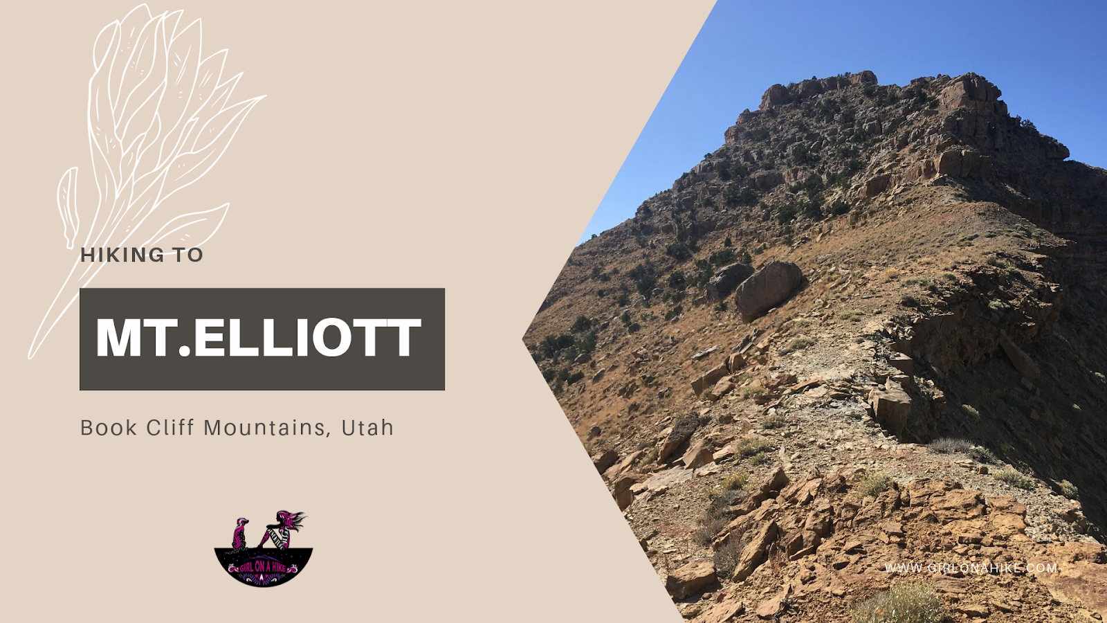
Mt.Elliott (7,142 ft) is located along the Book Cliff Mountains, in between Price, Utah and I-70. Ever driven to Moab from SLC? Then you've passed this peak and know exactly where it is! Near the town of Woodside, UT there is an abandoned gas station with people sometimes selling jerky. Look directly up and SW, and you'll see this pointy peak clearly. You can't miss it, it sticks out because of it's jagged yet isolated summit. This obscure peak ranks #24 out of 29 on the Utah Country Prominence Peak list, and because of its low popularity, only a handful of people will make it to the summit each year.
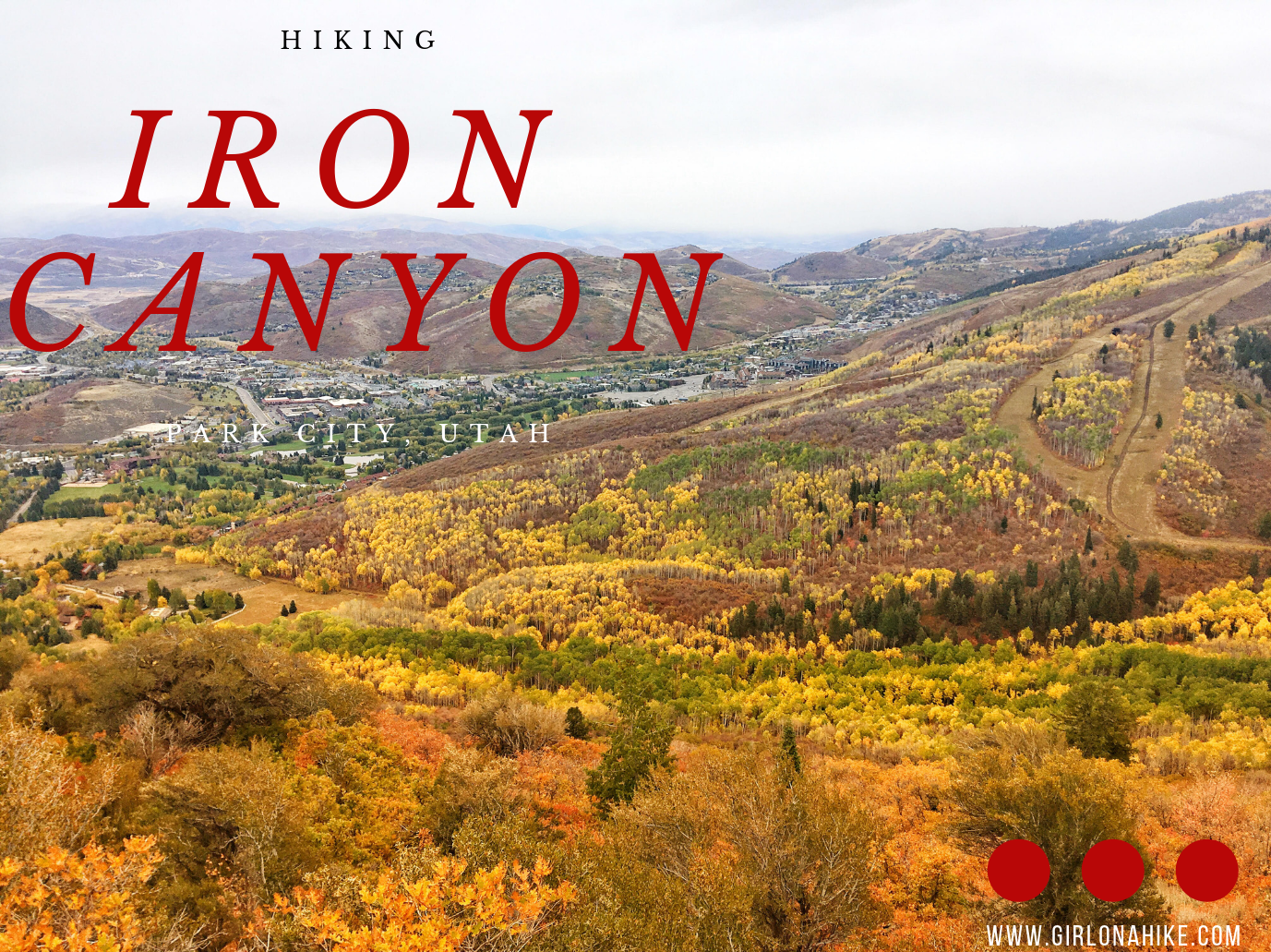
Iron Canyon in Park City, Utah is a beautiful, secluded trail that overlooks the Park City valley and the ski resorts. On a clear day you can see all the way out to the Uinta Mountains. The trail is more popular in winter as a fun sledding spot, but my favorite time to go is in early Summer when everything is turning green again. Most of the mountain is on private land, but the Iron Canyon trail allows for public access.
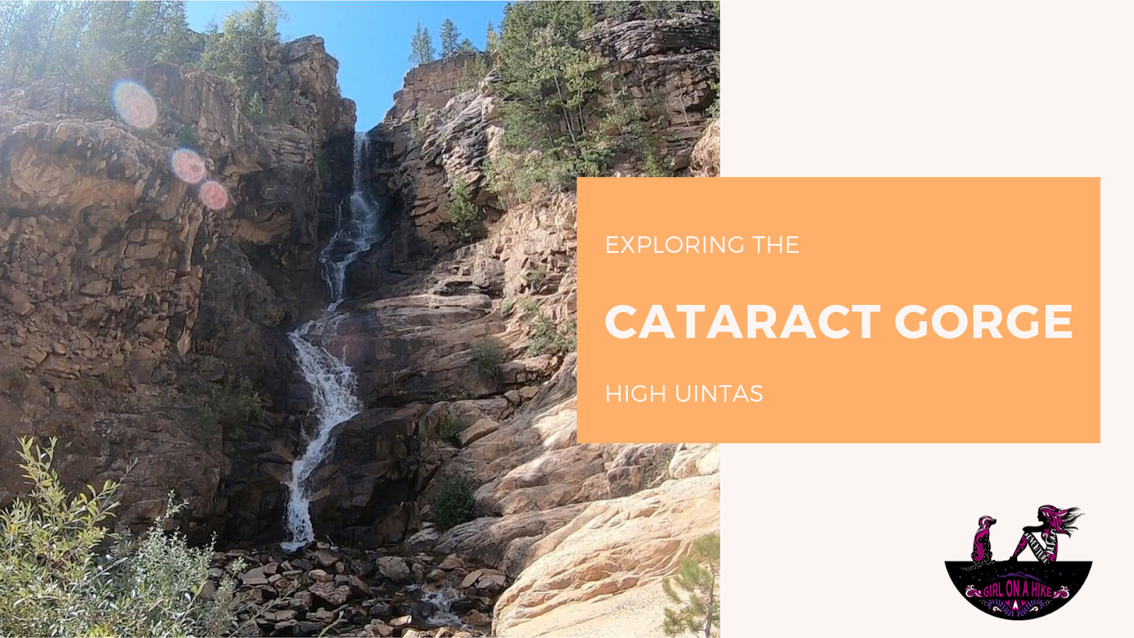
The Cataract Gorge is located near Murdock Basin in the High Uintas. After turning off the Mirror Lake Highway, you'll drive 3 miles along a well-graded dirt road until you reach the forest road intersection for FR027.
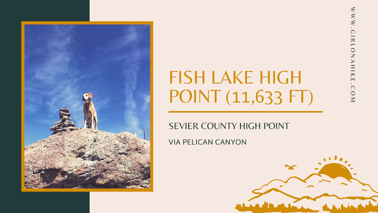
Fish Lake Hightop (11,633 ft) is the Sevier County High Point, and popular among those completing the Utah County High Points (CoHPs) list. Fish Lake Hightop was my very last one and I was sooo excited to finish the list! My very first CoHP was actually Deseret Peak back in 2014, so this list took me years to complete. When I first started bagging peaks I didn't know the CoHP list even existed I just wanted to hike to cool places. Fish Lake Hightop was no different - it took me to a new part of the state I had never been, Fish Lake, which is about an hour southeast of Salina, UT.
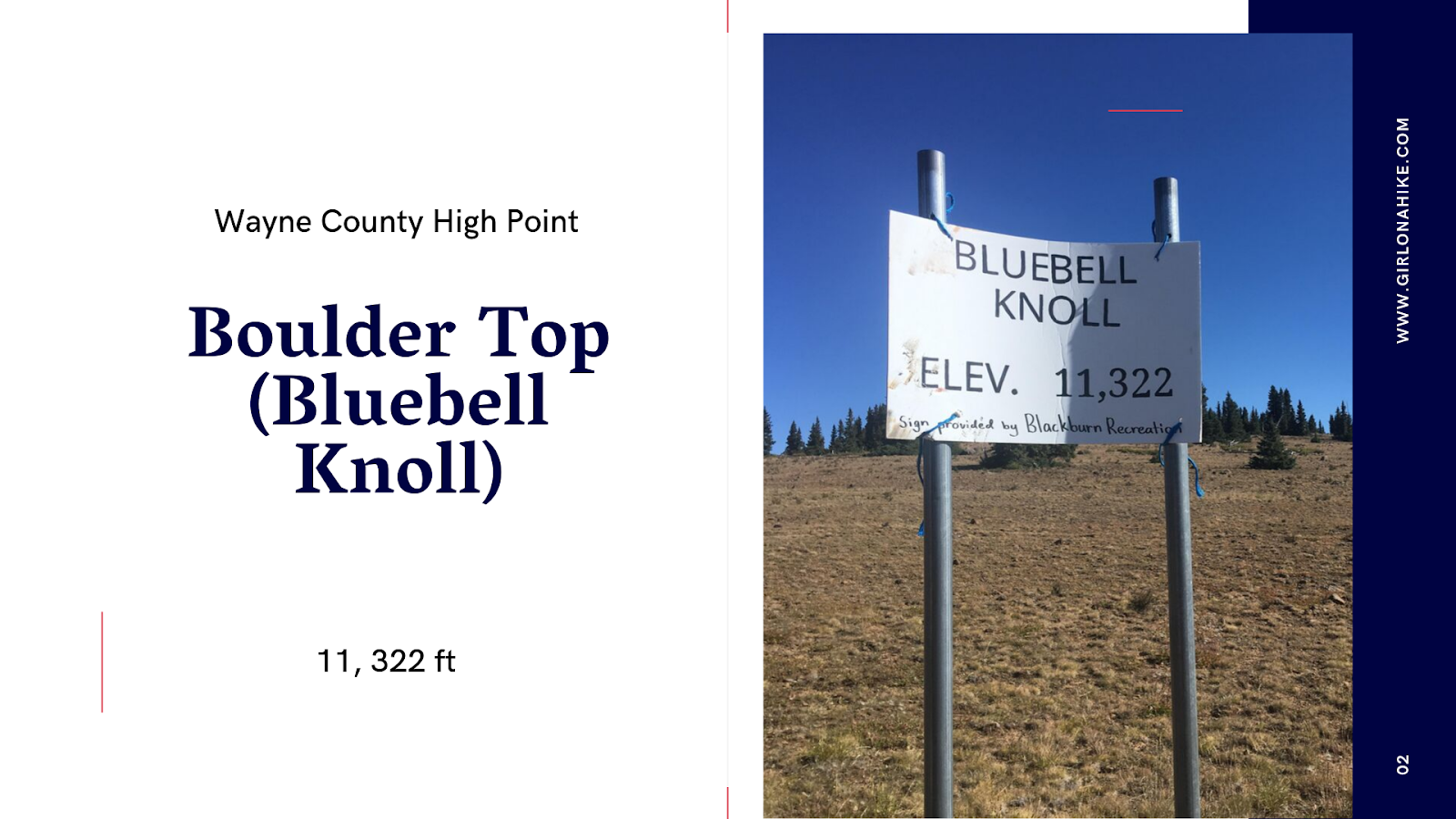
Boulder Top (aka Bluebell Knoll) sits at 11,322 ft high on the Aquarius Plateau, in-between Loa, Utah and Boulder, Utah. Most people come to this "peak" to mark it off their list on the Utah County High Points (CoHPs), for Wayne County. On that list, it is one of the easiest. It's not a hike, but rather a scenic drive with about a 10 minute walk to the summit, which sits in a grove of forested trees, yet also has a view of the nearby Raft Lake just below the summit.
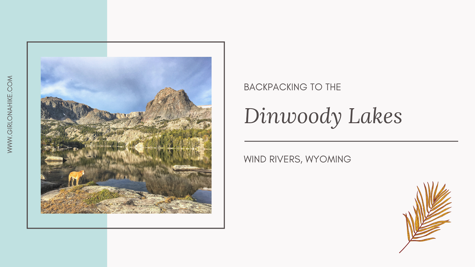

The Dinwoody Lakes area is located in the Wind River Range, and is a popular area for backpackers.
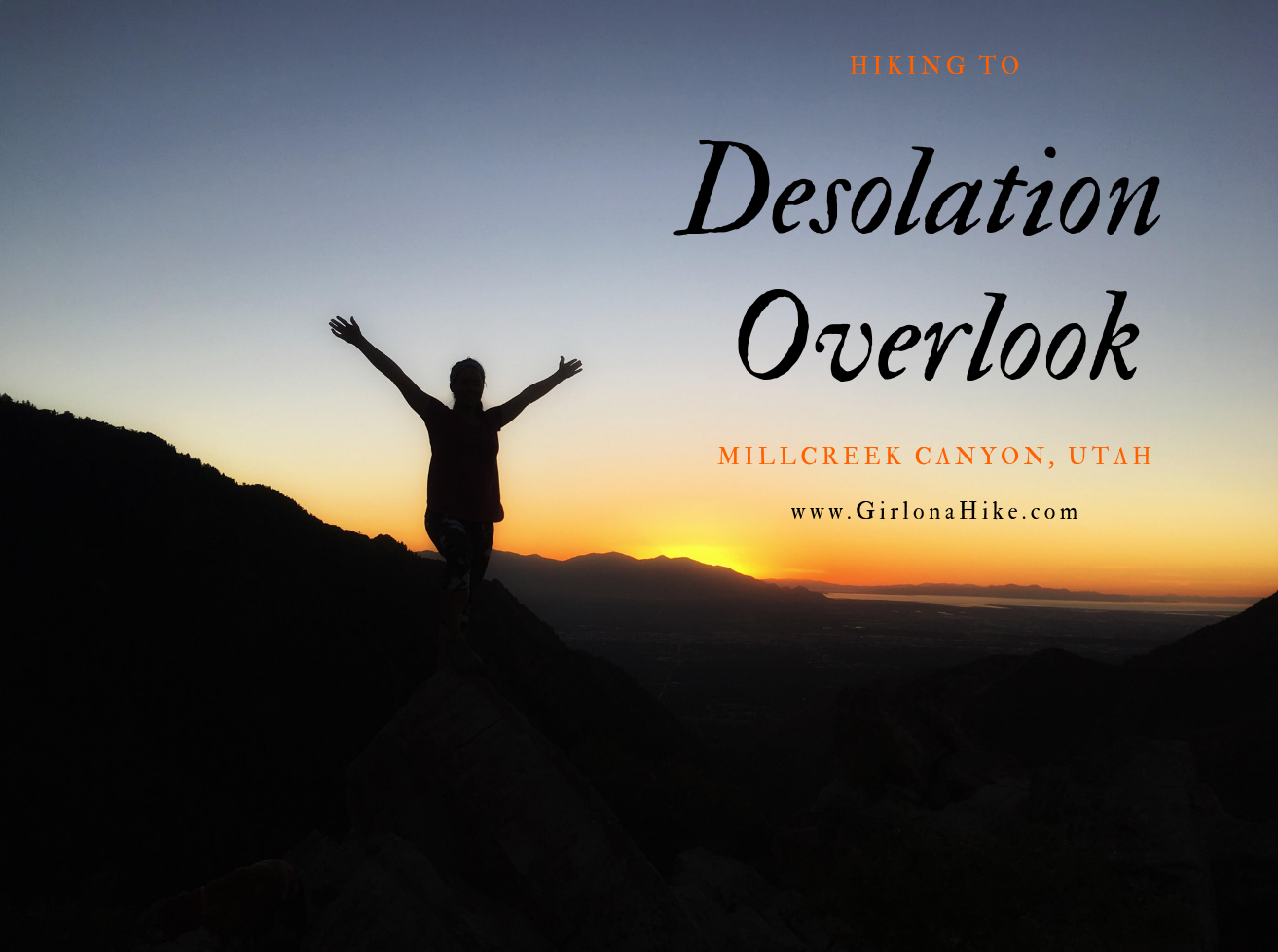
Desolation Overlook is a popular trail located in Millcreek Canyon that can be hiked year round. I love taking the dogs up here for a great view of the canyon and valley in the distance. The trail is on the north slope, so it is very shaded, and in winter, can be very icy. Be sure to wear microspikes in Winter to keep from falling. The trail makes its way up the side of the mountain using long switchbacks. This trail is accessible year-round, with my favorite being Fall.
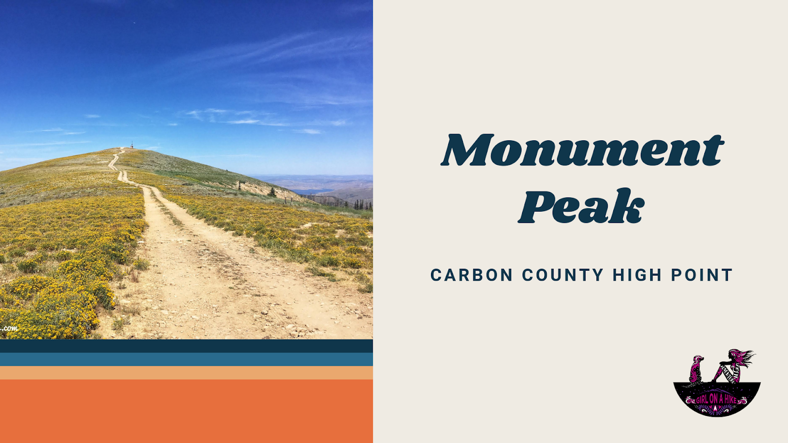
Monument Peak (10, 452 ft) is the the Carbon County High Point, and for those working on the Utah County High Points (CoHPs), this one is the easiest since you can drive to the summit. It's located along the Wasatch Plateau, and because its simply a drive, it should be combined with other CoHPs such as East Mountain and South Tent Mountain. There is nothing special about this peak except for the fact that you can see three CoHPs from the summit. The best time to drive here is in late Summer to Fall when the road is completely dry.