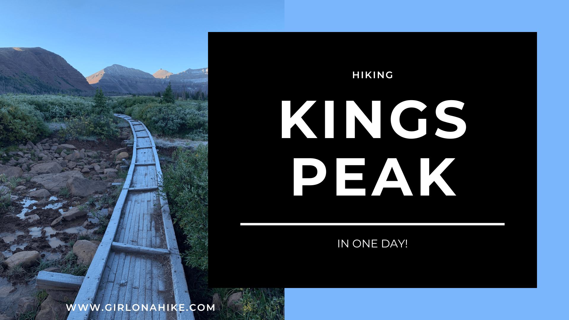
Kings Peak is Utah's Tallest mountain at 13,528 ft! Most people do this as a backpacking trip, but if you like ultra running, then doing it in a day is a huge accomplishment!
About
Coming in at 26 miles round-trip, most people
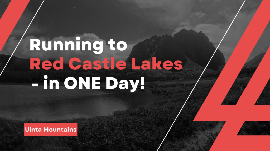
Red Castle Lakes is one of the most popular areas in the High Uintas Wilderness due to its remote beauty that not only attracts hikers, backpackers, and fishermen but also runners!
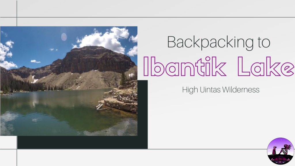
Ibantik Lake ("eye-ban-tick") is located conveniently close to the Mirror Lake Highway in the High Uintas, and backpacking this route is perfect for beginner backpackers since it's a fairly short yet rewarding trail. It is a very popular lake to camp at, and therefore you won't have much solitude. The best things about this lake is how clear the water is, and you'll see plenty of mountain goats as Notch Mountain looms above you. The trail is really easy to follow, and is best done as a point-to-point route.
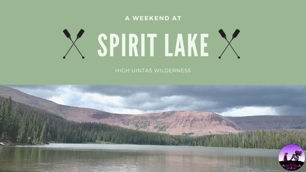
Spirit Lake sits in the High Uintas Wilderness on the far East end of the range, with the lake at 10,180 ft. Access to this area is only open from the end of June (sometimes early July depending on the snow pack) through October.
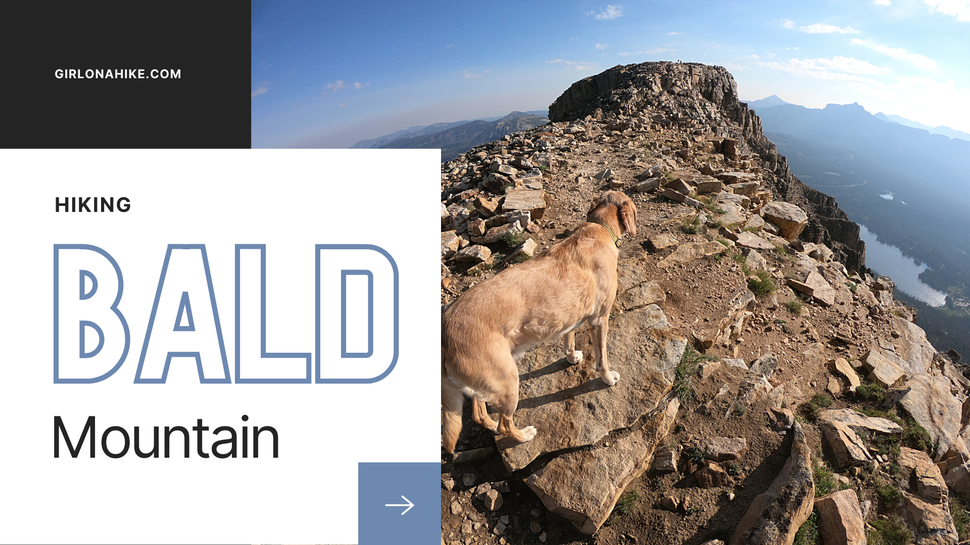
Bald Mountain (11,942 ft) in the High Uintas Wilderness is one of my favorite peaks to summit. Not only is this peak one of the easiest to summit in the area, but it also offers grand views of the Mirror Lake Highway, surrounding lakes, several peaks, and on a clear day you can see Mt. Timpanogos. Along the Bald Mountain trail you may see mountain goats, pika, squirrels, and an abundance of wildflowers in early summer. As with any high altitude terrain, start this hike early in the day to beat the daily afternoon thunderstorms, the afternoon heat, and crowds.
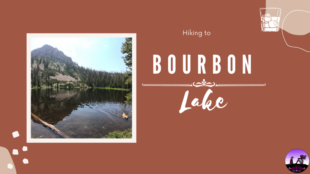
Bourbon Lake sits at an elevation of 9,800 ft and offers a beautiful high alpine lake in the High Uintas Wilderness. This lake gets its name from the color of the lake - the deep amber color reflected against the surrounding cliffs creates an amazing reflection of yellow and golds.
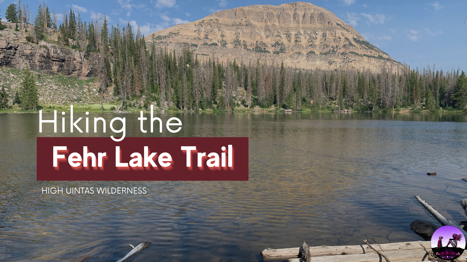
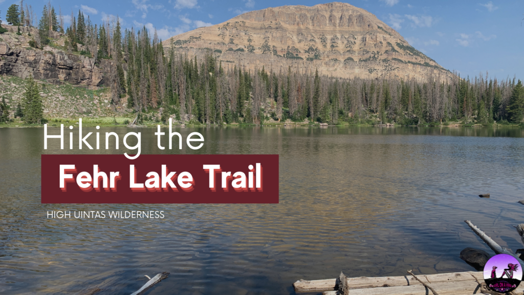
The Fehr Lake Trail (pronounced like "Fair") sits high in the Uintas Wilderness at 10,260 ft, and offers a few hiking options from really easy and short at 1 mile round trip, to a little longer at 4 miles round trip.
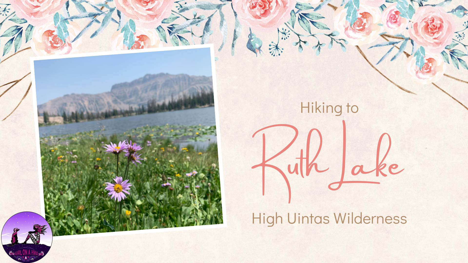
Ruth Lake sits high in the Uintas Wilderness at roughly 10,200 ft. Ruth Lake is one of the easiest trails in the Uintas, making it great for families with children, or perfect for the beginner backpacker.
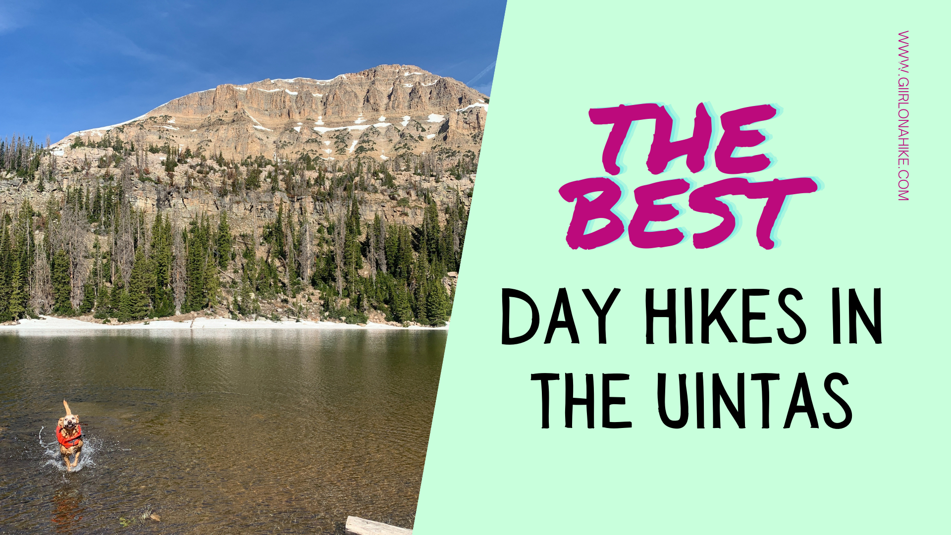
Check out my list of the BEST Day Hikes in the Uintas! The High Uintas Wilderness offers some of the best day hiking near Salt Lake City. It provides for a fun, quick getaway that you can do in one day. If you have time, I highly recommend backpacking this mountain range as well. The Uintas are the only mountain range in the lower 48 states that run East to West. The Uinta Mountains extend for 100 miles across Northeast Utah, and a small part of Northwest Colorado, bordered by the Wasatch Mountains to the West.
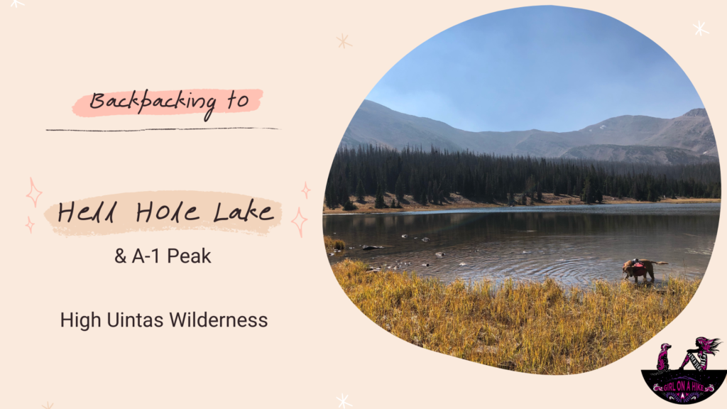
Hell Hole Lake (HHL) is located in the High Uintas Wilderness, and is a beautiful alpine lake surrounded by a bowl of mountains, including A-1 Peak and Kletting Peak. After a 3.5 mile walk along the road, the route follows the Main Fork Bear River Trail. The entire route is very gradual, only gaining 1,700 ft over 6.7 miles.
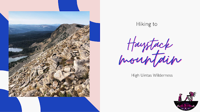
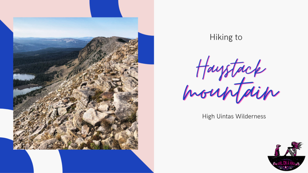
Haystack Mountain (10,985 ft) is a long, prominent ridge in the High Uintas, easily accessed from the Crystal Lake Trailhead. Not to be confused with this Haystack Mountain in the LaSal Mountains near Moab, this one is much easier and shorter!
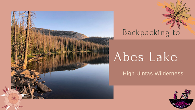
Backpacking to Abes Lake is located in the Uinta Mountains, and sits and an elevation of 9800 ft. The trail follows the Middle Fork of the Weber River for the first 3 miles, then take a sharp left turn where the trail gains 1200 ft in just 1.2 miles before reaching the lake. The trail gets very hot in the middle of summer, and the dirt trail can get too hot for dogs' paws and potentially yourself.
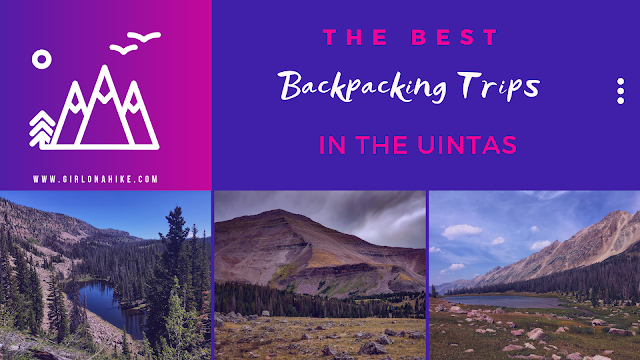
The Best Backpacking Trips in the Uintas are just around the corner from Salt Lake City, not more than a few hours drive! The best parts about backpacking in the Uintas are that there is plenty of shade, water, a mix of level and steep trails, plus dogs are allowed off leash! There's something for everyone, so check out these trips below! Not ranked in any order, click the title of each trip to learn more. Be sure to use a tracking app such as Gaia GPS (my personal fav!) and/or a paper map so you don't get lost.
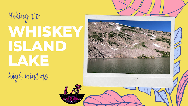
Whiskey Island Lake sits at 10,400 ft in the High Uintas and is a secluded lake great for a day hike and fishing. If you're really feeling like getting a workout, add on the surrounding peak above the lake, Whiskey Island Peak.
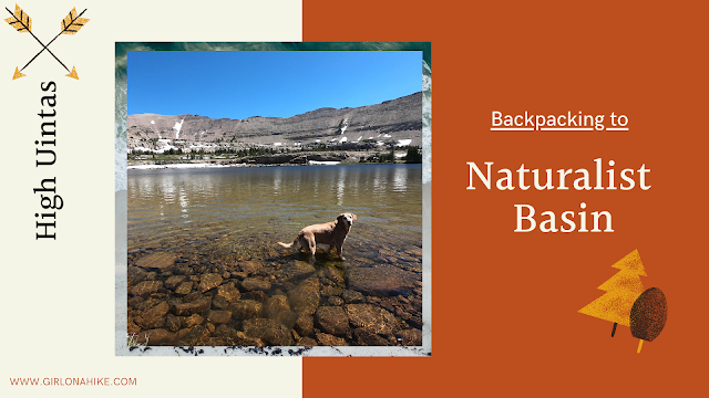
Naturalist Basin is located in the High Uintas Wilderness, and home to several lakes including the popular Blue Lake and Jordan Lake. Because Jordan Lake is only 6.5 miles one way, this makes for a great backpacking destination or a bigger day hike!
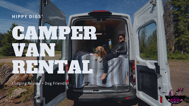
Check out this Hippy Digs Rental Van! We got to experience #VanLife while "camping" in the Uintas. We found out about Hippy Digs and had to take their rental camper van out for a spin - in fact, we were their first every people to rent out this newly flipped van and it was THE BEST! Spent two nights in what I call "luxury" - running water, queen sized bed, a kitchen with plenty of storage space, and best of all it's dog friendly! Van owners, Mylee & Chris, bought this 2019 F250 Frontline van after a conversation at their normal Friday night dinner date. After coming up with a blueprint sketch on the dirty table napkin, they knew right then this was something they had to make happen.
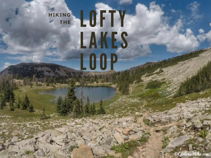
The Lofty Lakes Loop in the Uintas is a beautiful 4 mile loop that takes you past several high alpine lakes, a few cool overlooks, and is a relatively easy hike for most people.
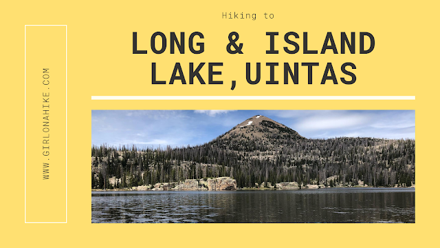
Island Lake is one of many gorgeous lakes in the Uintas - it can be hard to choose which lake to visit. This lake offers a quick backpacking trip, cliff jumping, swimming, fishing, & solitude in the summer months. If you are feeling adventurous, you could even hike up to one of the three surrounding peaks. Hiking to Island Lake is an easy, family friendly hike, that even the dogs can join in on.
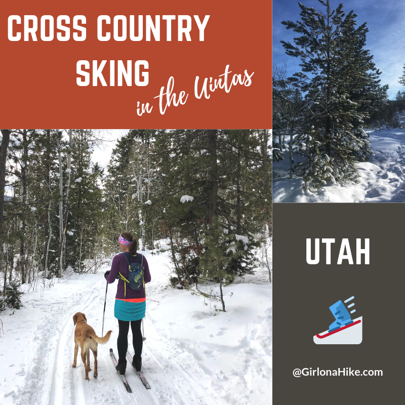
Cross country skiing in the Uintas is one of my favorite winter activities! I've been cross country (XC) skiing since 2008 when I lived in Montana. My favorite place to ski was Lone Mountain Ranch, but when we moved to Utah, no resort compared to that. So, I had to find new places to ski, and of course, I wanted to bring Charlie along. Yes, Utah has some small xc ski resorts like White Pine Touring, but you can't bring dogs to those places. Round Valley is a nice dog-friendly option but gets boring after awhile. The past few years I've been dying to get out and xc ski in the Uintas but didn't have a good car to get there in winter. I was afraid my little Sonata would get stuck, and I didn't want to deal with it.
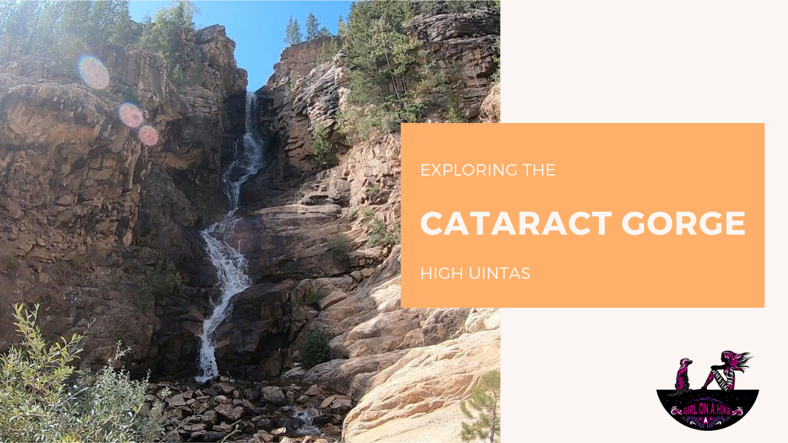
The Cataract Gorge is located near Murdock Basin in the High Uintas. After turning off the Mirror Lake Highway, you'll drive 3 miles along a well-graded dirt road until you reach the forest road intersection for FR027.
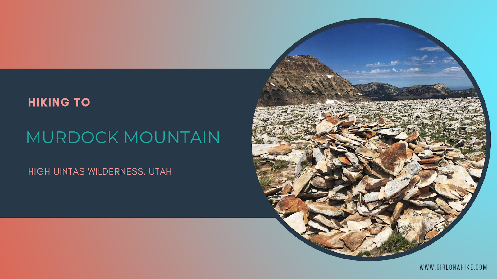
Murdock Mountain (11,212 ft) is located in the High Uintas Wilderness, right off the Mirror Lake Highway. While its neighbor peak, Bald Mountain, see hundreds of hikers each summer, less than 50-75 people will make the Murdock Mountain summit each year. While there is no trail, hiking up the boulder field is fairly easy and only 1 mile to reach the top. The 360 degree views can't be beat, and you're not likely to see people up there either.
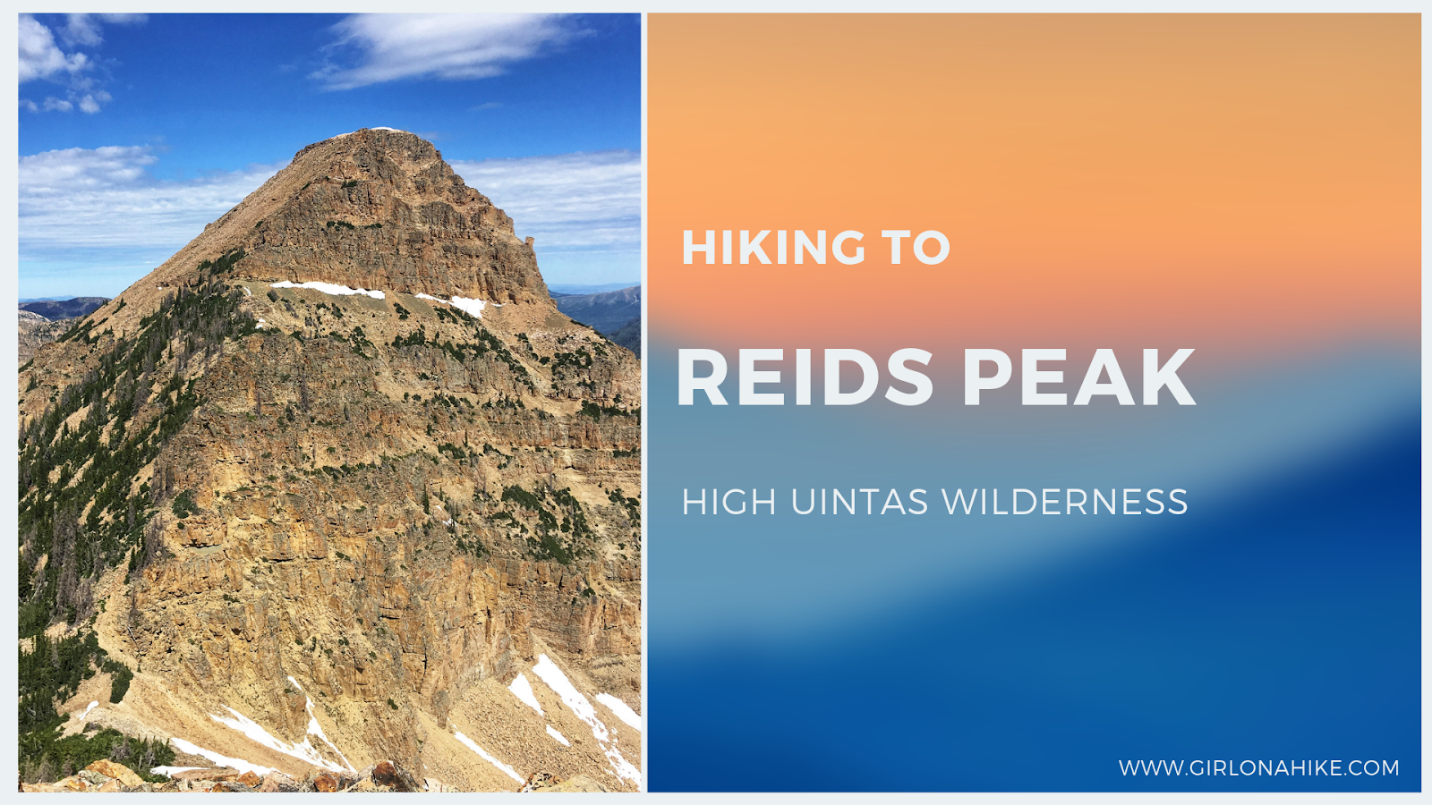
Reids Peak (11,708 ft) is located in the High Uintas Wilderness, just off the Mirror Lake Highway. While its neighbor peak, Bald Mountain, see hundreds of hikers each summer, less than 50 people will make the Reids Peak summit each year, and for good reason. There is no trail to the summit and requires light scrambling, so it's not a good peak for the average/newbie hiker. Typically, only experienced peak baggers are the ones looking to make the summit, and knowledge of route finding will make this hike successful.
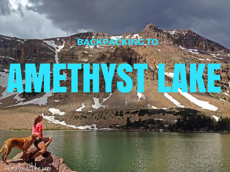
Backpacking to Amethyst Lake in the High Uinta Wilderness is a backpackers dream - a high alpine lake, lots of hiking and fishing, great campsites, not too many people, and cooler temperatures. Although the hike in is somewhat tough (especially if you are carrying a 30-40 lb pack), the reward and view is well worth the hard effort.
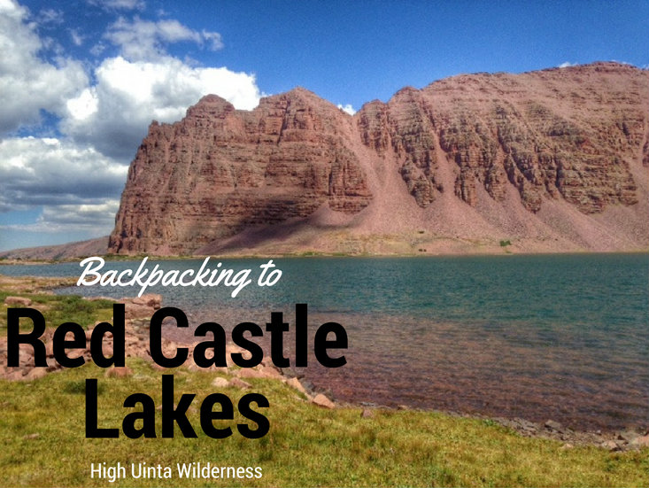
Red Castle Lakes is sure to be on everyone's Uintas "to-do" list, especially if you are a backpacker. Not only does the Red Castle area offer four high alpine lakes to chose from, pristine meadows, and great backcountry camping, it also offers a stark contrast of red peaks and a ridgeline to clear blue water that make for great photography. The only thing you won't find at Red Castle Lakes? Solitude.
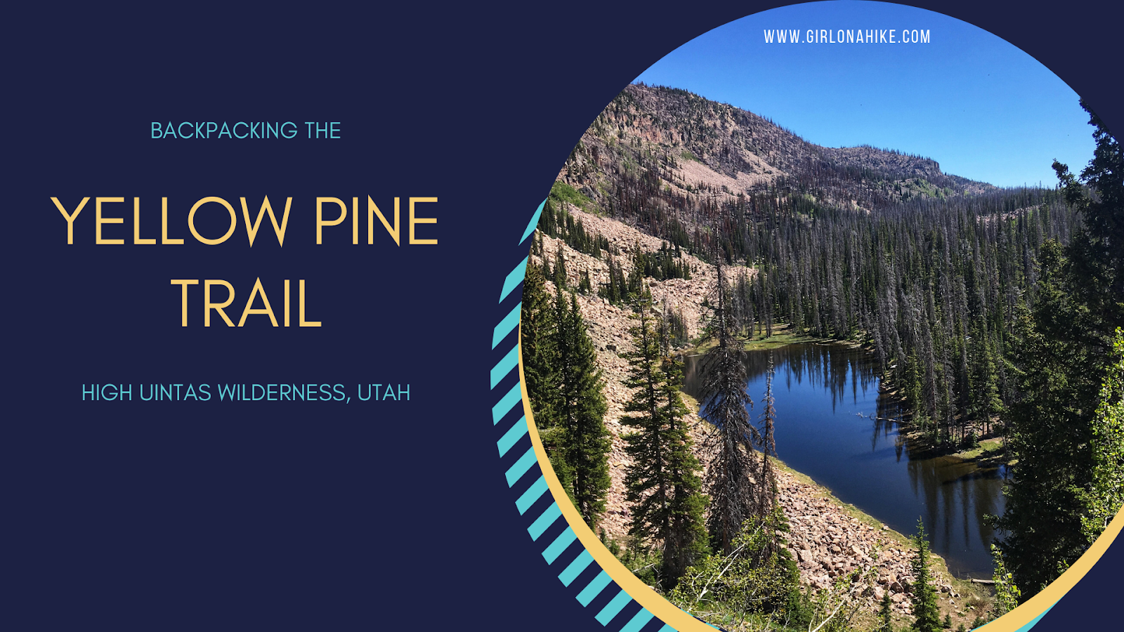
The Yellow Pine Trail is one of the first trailheads you will pass after entering the Mirror Lake Highway, coming from Kamas, UT. The trail leads to three lakes - lower & upper Yellow Pine Lakes, as well as Castle Lake. You can also day hike to Duke & Castle Peak, both over 10,000 ft. This is a great early-season backpacking route when the higher Uintas is covered in snow. The trail is mostly well shaded and offers plenty of water along the way for your pup to drink from or to filter from. It is slightly steep and rocky in sections, so this trail took longer to reach the lakes than anticipated. The best time to hike here is late June though October, or when the first snow flies.
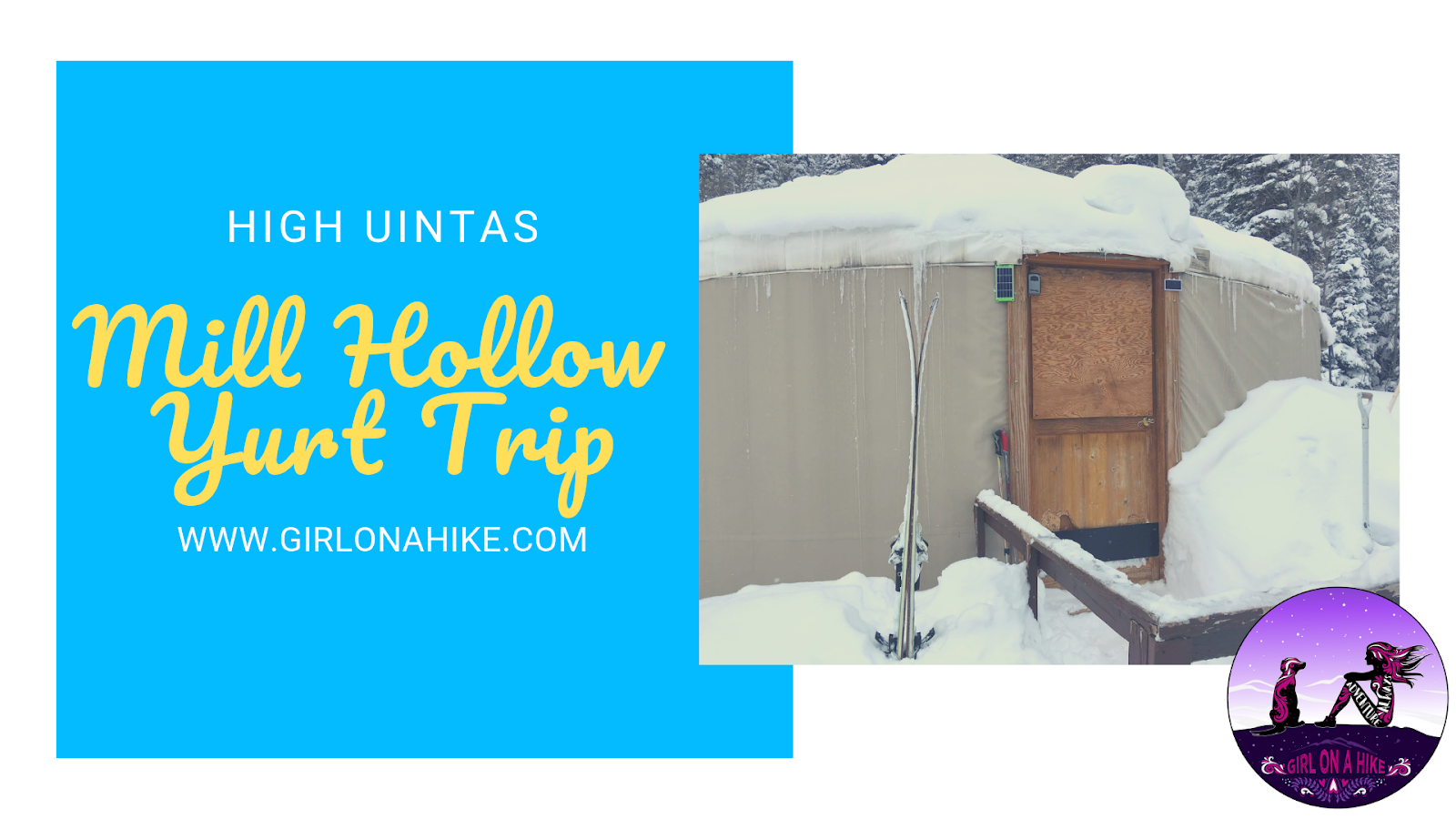
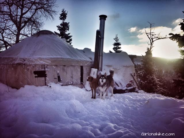
The Mill Hollow Backcountry Yurt is located in the High Uintas Wilderness, with a 6 mile hike/ski/snowshoe to reach the yurt. The "trail" follows HWY 35 for 3 miles, before turning off onto forest roads. This ski in requires you to have comfortable backcountry skills, as well as appropriate gear (beacon, shovel, & probe), as avalanches have occurred here. The hike/ski in is well worth it, as you are surrounded by a winter wonderland, yet have a warm hut to hang out in. Plan to spend at least two nights here - one night is not enough to fully enjoy the area, get out for a tour, or relax.
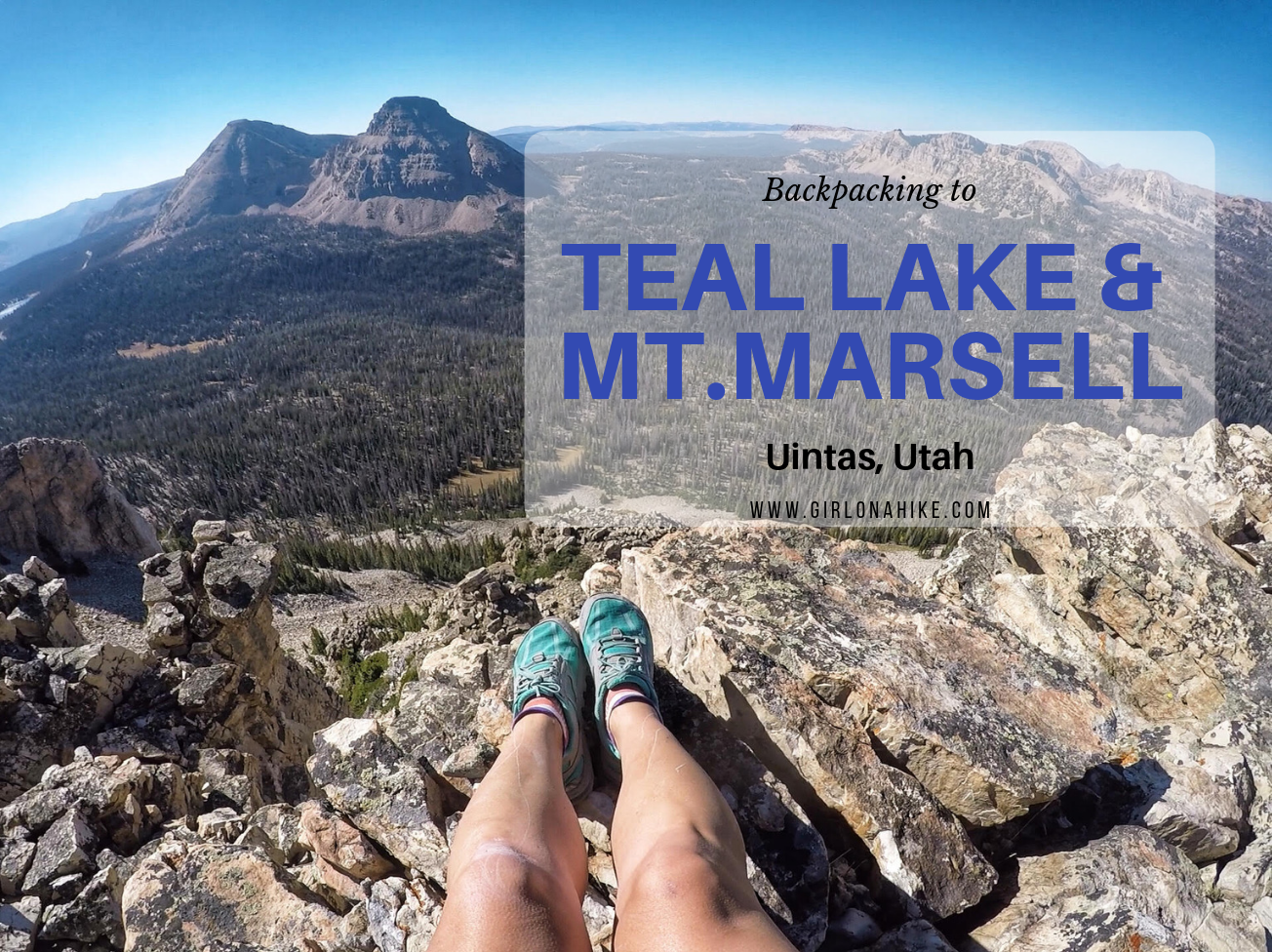
Teal Lake sits at an elevation of 10,400 ft, and is accessed via the popular Ruth Lake Trailhead. You will follow this trail for the first mile, and then after that there is no trail. You should be comfortable with a little route finding, and hiking off trail. The nice thing is that Teal Lake is a mere 2.2 miles, so you really only have to hike off trail for 1.2 miles. You'll pass a few unnamed ponds, Jewel & Naomi Lakes, then reach Teal Lake. There are several nice campsites at Teal Lake, and fishing is plentiful.
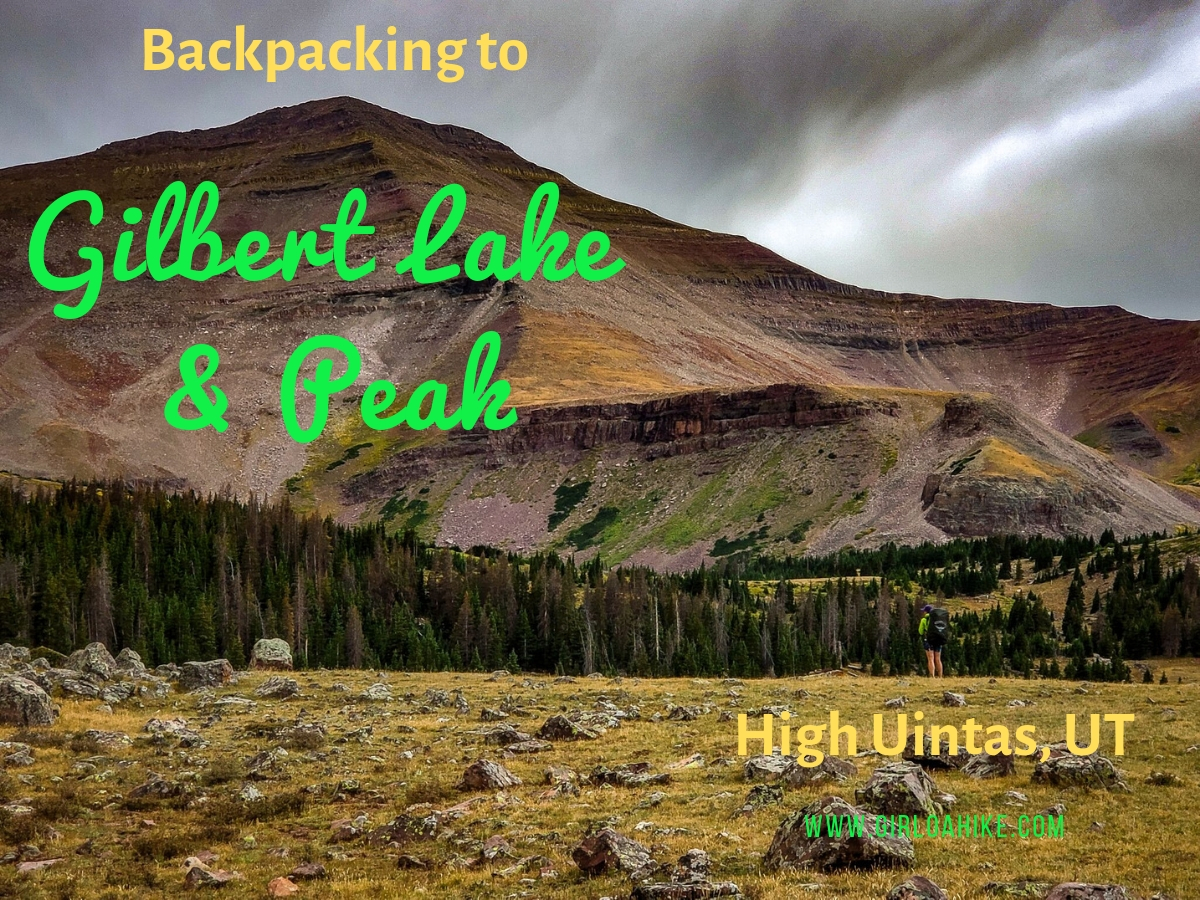
Gilbert Lake is located in the High Uintas Wilderness on the East end of the range, with Gilbert Peak (13,442 ft) being one of Utah's "13ers" (a peak above 13,000 ft). It is the 3rd highest peak in the state, and the second highest county high point, and can be access by several drainages, with Henry's Fork being the most popular, however we accessed it from Gilbert Lake. The trail to Gilbert Lake follows the West Beaver Creek trail for 9.2 miles before reaching the basin which has four lakes total, great campsites, lots of wildlife, and of course, fairly "easy" access to the peak.
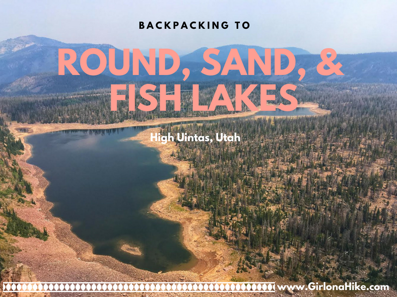
Backpacking to Round, Sand, and Fish Lakes are part of the upper Weber River drainage on the Western end of the Uinta Mountains. The trail steeply follows the Dry Fork stream and canyon, as it makes it way to the three lakes. Camping and fishing are plentiful here. Round Lake is actually home to three species of fish (somewhat unheard of in the Uintas, as there are typically only two species in the lakes). There are Grayling, Brook, and Cutthroat Trout. Further ahead is Fish Lake, which can vary in depth by 19 feet, depending on the snow year and dam levels. Plenty of day hiking options are available too, as most day hikers try to reach the ridge for better views. This route is kid and dog friendly!
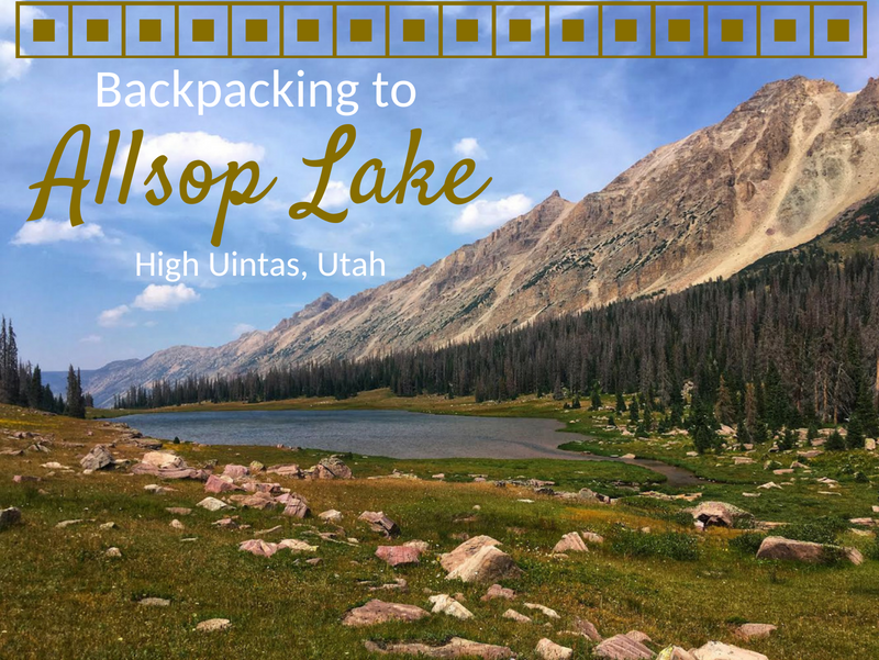
Allsop Lake sits on the Northern slope of the High Uintas Wilderness at an elevation of 10,600 ft. It's 9 miles to the lake, so it makes for a perfect 1 or 2-night backpacking trip. The trail is fairly mellow, only gaining 1,600 ft and has one switchback. Allsop Lake is full of brook and tiger trout, and there are a few day hiking options from the lake as well including Cathedral Peak, Allsop Peak, and Yard Peak. This trail is dog friendly, however be aware that free-range livestock graze along the entire route. Plenty of tent and hammock sites line the lake for a perfect campsite. Keep in mind that the Uintas have regular afternoon thunderstorms, so be prepared for any kind of weather.
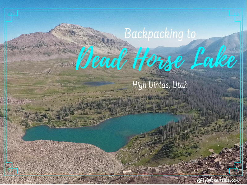
Dead Horse Lake is in the High Uintas Wilderness, and offers an 11 mile hike through large, open meadows, stunning vistas, and of course, leads you to a turquoise lake. This lake offers a great spot for fishing and day hiking. People hiking the Uinta Highline Trail also pass right by Dead Horse Lake. It's a dog friendly trail, though you'll want to give the sheep herds passing by in the meadows plenty of space. Bring your hammock or tent - there are several nice campsites around the lake and plenty of trees for shade. Be sure to check fire restrictions before heading out.
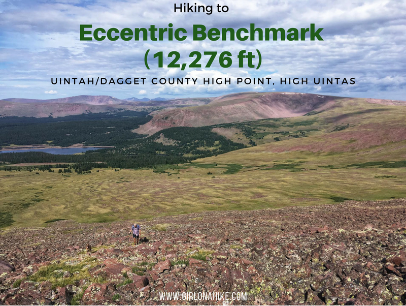
Eccentric Benchmark (12,276 ft) is the highest point for both Uintah & Daggett Counties in Utah, making it a popular summit for peak baggers. It's a high, rounded mountain in the Far East Uintas. What it lacks in views from the summit, makes up along the cross country trek with views as far as King's Peak to the West, and the Flaming Gorge to the Northeast.
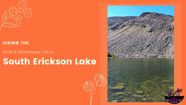
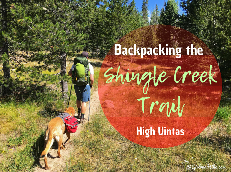
The Shingle Creek Trail in the High Uintas is a popular trail for an "early season" trail for hikers and backpackers to follow when the higher elevations haven't thawed out from winter. I have driven past this trail so many times, yet had never done it - until now! I decided to head up for one night with two friends and our destination was South Erickson Lake. East Shingle Creek Lake is more popular, but a little lower in elevation, and seemed to have more mosquitos so we wanted to keep going.
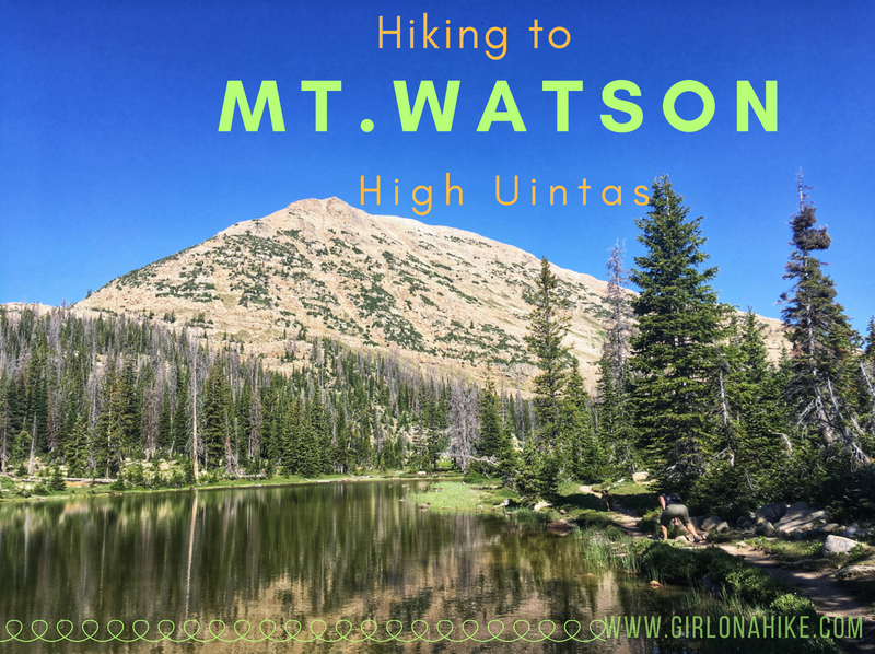
Mt. Watson (11,521 ft) is located on the West end of the High Uintas Wilderness, and though it is surrounded by several popular trails and lakes, most people do not summit this peak. There is a trail for the first 2 miles, but you're on your own after that to reach the top. That's what makes part of this peak fun - it's a "choose your own path" adventure!
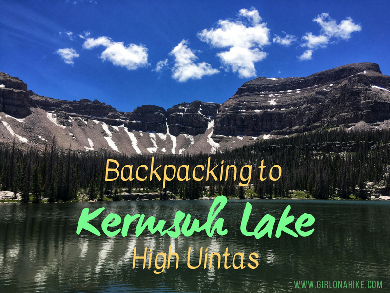
Kermsuh Lake is an alpine lake in the High Uintas Wilderness. It sits at an elevation of 10,200 ft, making it the perfect cooler destination while the SLC valley is baking in heat. Kermsuh Lake sits in one of the three basins in Christmas Meadows - Ryder and Amethyst Lake are the other two, more popular lakes.
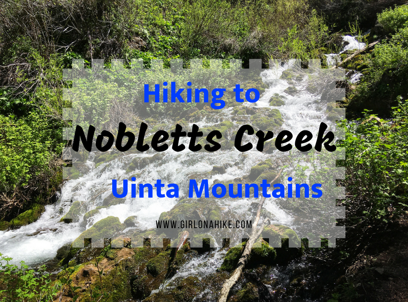
Noblett's Creek, located in the Southwestern end of the Uinta Mountains, is a good early/pre-season hike when the rest of the high elevation hikes in the Uintas are still covered with snow and mud. Because Noblett's Creek is at an elevation of 7,400 ft it is typically ready to hike by end of May/early June (depending on the snow pack from Winter). This trail is really short at only 2 miles round trip, making it perfect for families and kids.
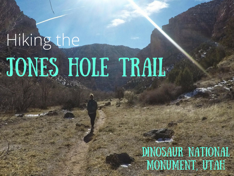
The Jones Hole Trail is located in the northern section of Dinosaur National Monument (DNM) on the Utah side - DNM also stretches across to Colorado. This area and trailhead (TH) is home to the Jones Hole National Fish Hatchery,where rainbow trout, brown trout, and brook trout are raised to stock areas in Utah, Wyoming, and Colorado. The Jones Hole Creek runs alongside the hatchery, and eventually flows into the Green River, where the trail ends. The trail itself is very mellow, gradually descending as it reaches the confluence. Take a short side trip to Ely Falls and the pictographs, before continuing down stream. Big Horn sheep are often spotted in this canyon.
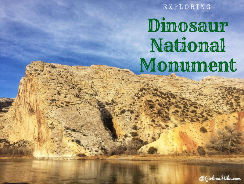
Dinosaur National Monument (DNM) is located in both Utah and Colorado - the Utah side is just outside of Vernal, Utah and offers a large dinosaur quarry, trails, camping, and amazing scenery of the Uintah Basin and Green River. Petroglyphs hint at earlier cultures (mainly the Fremont), and later homesteaders and outlaws found refuge here. Of course the name of the game here are the dinosaur fossils. Visitors can see over 1,500 dinosaur fossils exposed on the cliff face, located inside the Quarry Exhibit Hall. It's one of the most amazing sites for Paleontologists and explorers-alike. Plan to spend at least one full day at DNM.
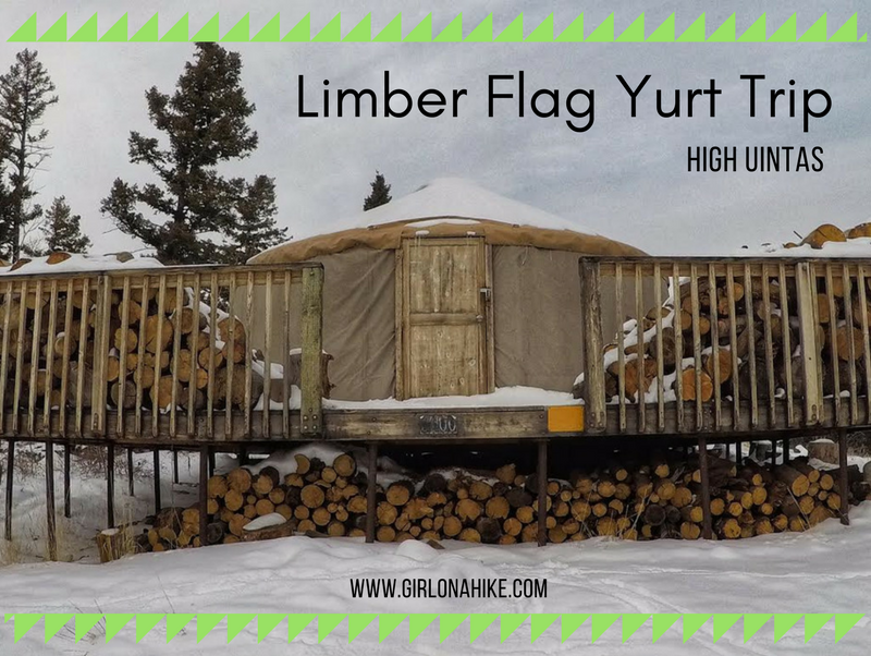
The Limber Flag Yurt is in the far East Uintas, roughly 33 miles north of Vernal, Utah and only 16 miles south of the Flaming Gorge Dam Visitor Center. The Limber Flag Yurt overlooks the Uinta Basin, and Red Fleet State Park area to the South - at night you can actually see Vernal's city lights! To get to this yurt requires a 3 mile hike (no motorized travel is allowed December - March). You can snowshoe or ski, though I don't recommend skiing here unless this area has a really big snow year. Otherwise you'll have to constantly pick up your skis to cross logs and low sage brush.
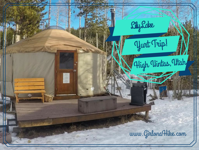
The Lily Lake Yurt sits at 9,000 ft elevation in the High Uintas of Utah and is only accessible during winter months. The Bear River Outdoor Recreation Alliance (BRORA), a non-profit corporation, manages the Lily Lake Yurt plus four other yurts including the Bear Claw Yurt, Ridge Yurt, East Fork Yurt, and Boundary Creek Yurt. Getting to the yurt in Winter typically requires snowshoes or skis and a little route finding. BRORA has done a great job of maintaining the yurts, placing trail signs, and protecting the Bear River area.
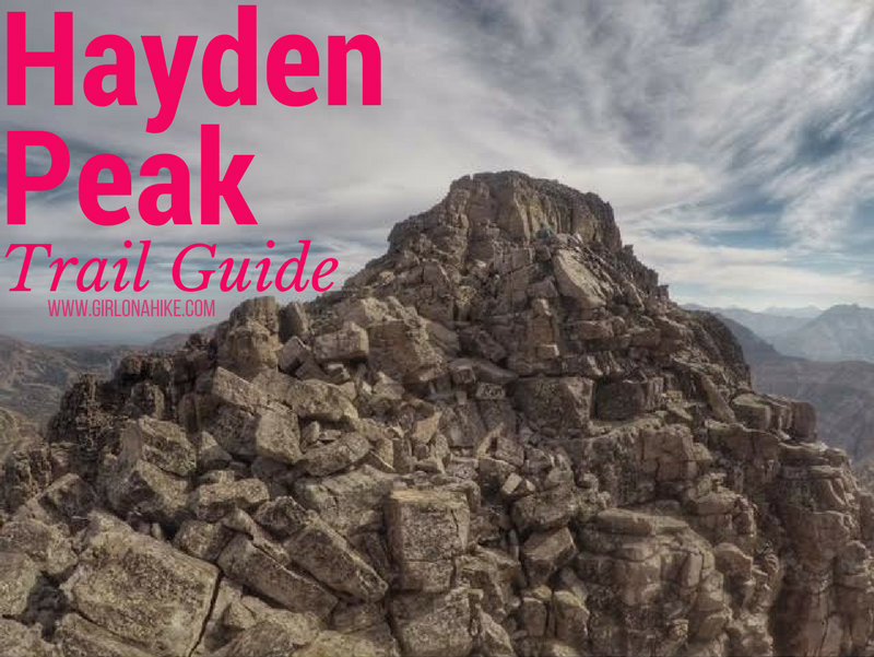
Hayden Peak (12,479 ft) stands out for anyone who's driven along the Mirror Lake Highway in the Uintas. This rugged peak is quite intimidating from the road, but for Peak Baggers that's nothing to prevent us from climbing it. Hiking to the summit of Hayden Peak is NOT for the beginner hiker nor the beginner peak bagger. You should be comfortable hiking across narrow ridges, class 3 scrambles, and route finding. There is either a very faint, or non-existent trail. Though this route is only 2 miles one way, you'll gain a total of just over 2,000 ft.
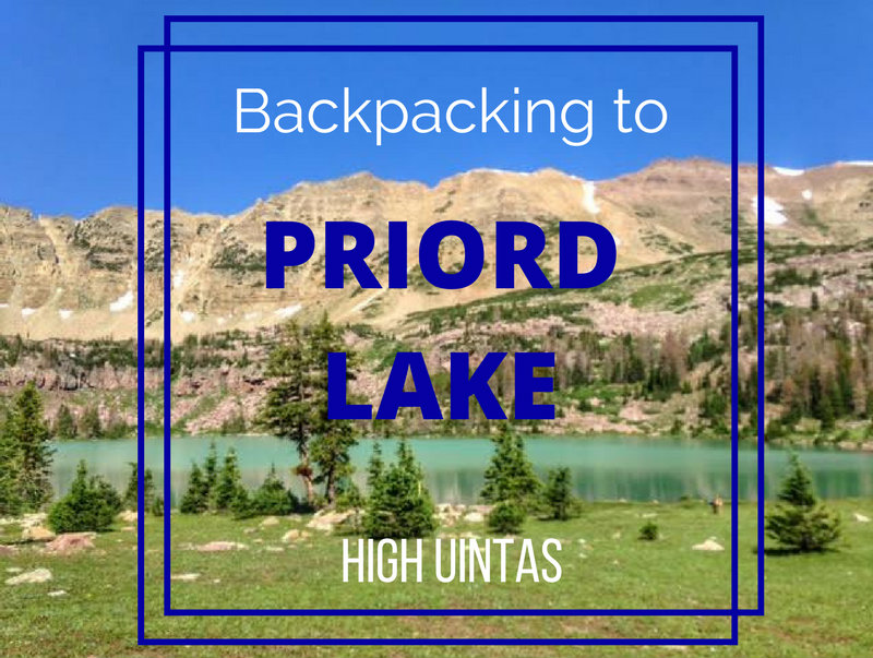
Priord Lake sits high in the Uintas in Ashley National Forest at roughly 11,000 ft. The water is an incredible turquoise color, with the Prior Cirque, Priord Peak, and Yard Peak as a beautiful backdrop. The scenery here is unreal, however it takes some advanced navigation skills to get there. The trail has the three bad "Ms" - marshy, mucky, and moist. Horse and cow poops also lines the trail. The trail is also either very faint, or non-existent at times, therefore, this is not a good trail for beginner backpackers.
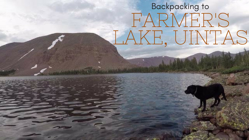
Farmer's Lake is a lake in the Timothy Lakes Basin in the High Uintas. The trail follows the Swift Creek Trail, as it gains 3,000 ft in 9 miles. There are several other lakes you could backpack to including East or West Timothy Lakes, and Carroll Lakes. Backpacking to this area requires at least a one night minimum stay - two nights is preferred. There is plenty to explore as a day hike in the area and even bag some peaks. The best part about this trail and lake is that we didn't see anybody over 3 days on a weekend! You'll find plenty of solitude here.
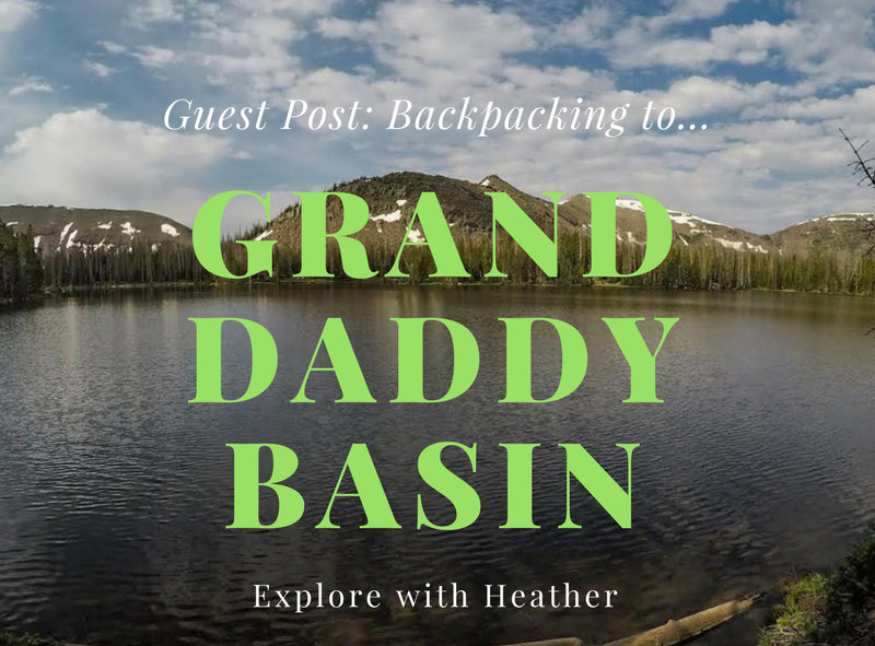
Today's Guest Post comes from Heather Lyon! She, her husband, and dogs recently took a backpacking trip to Granddaddy Basin in the Uintas, and she's here to let us know all about it!
By Heather Lyon
The Uinta National Forest about an hour due East of Park City, Utah is known for many things. Some of these include Kings Peak, over 1,000 alpine lakes, awesome fishing, and our favorite - prime backpacking. It's so simple to go there. Just buy a map, pick a trail, and how far in you want to go. You will surely find yourself with some of the best views at your chosen campsite for the evening.
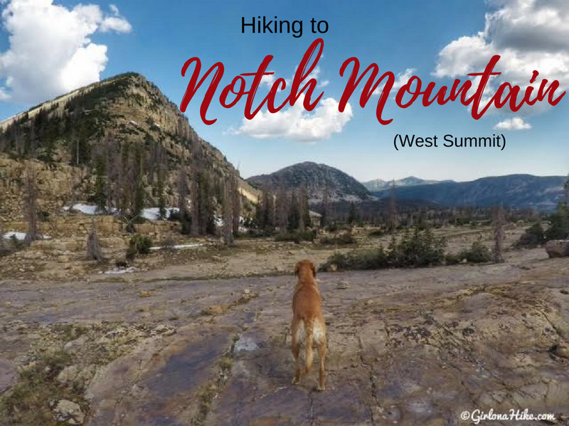
The West Summit of Notch Mountain (11,206 ft) is near "The Notch", an opening in between the West and East summits. The Notch is the high, open area on the Notch Mountain Trail by Lovenia Lake and Twin Lakes. Hiking to the West summit is fairly easy for seasoned peak baggers, and offers a good intro to peak bagging for newbies. There is a trail all the way to The Notch, after that you need to find your own route. It's not hard though, just steep hiking over medium sized boulders. Be careful where you step as some boulders are uneven - always test it out before putting all of your weight on the boulder.
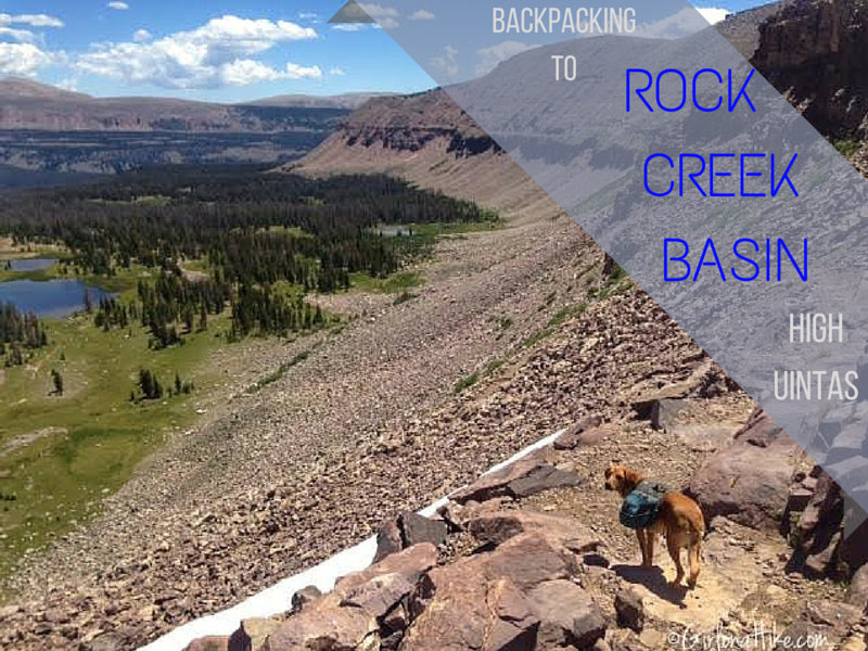
Rock Creek Basin is located in the High Uinta Wilderness, in between Rocky Sea Pass and Dead Horse Pass. Getting into the basin requires a minimum 9 mile hike; I highly recommend that you spend at least two nights in Rock Creek Basin to fully explore the area. Some people can backpack it in one night, but doing so won't allow enough time to see everything. There are three ways you can reach Rock Creek Basin: 1) via the Highline Trail from Hayden Pass 2) From West Black's Fork or 3) Rock Creek TH from the Stillwater Reservoir.