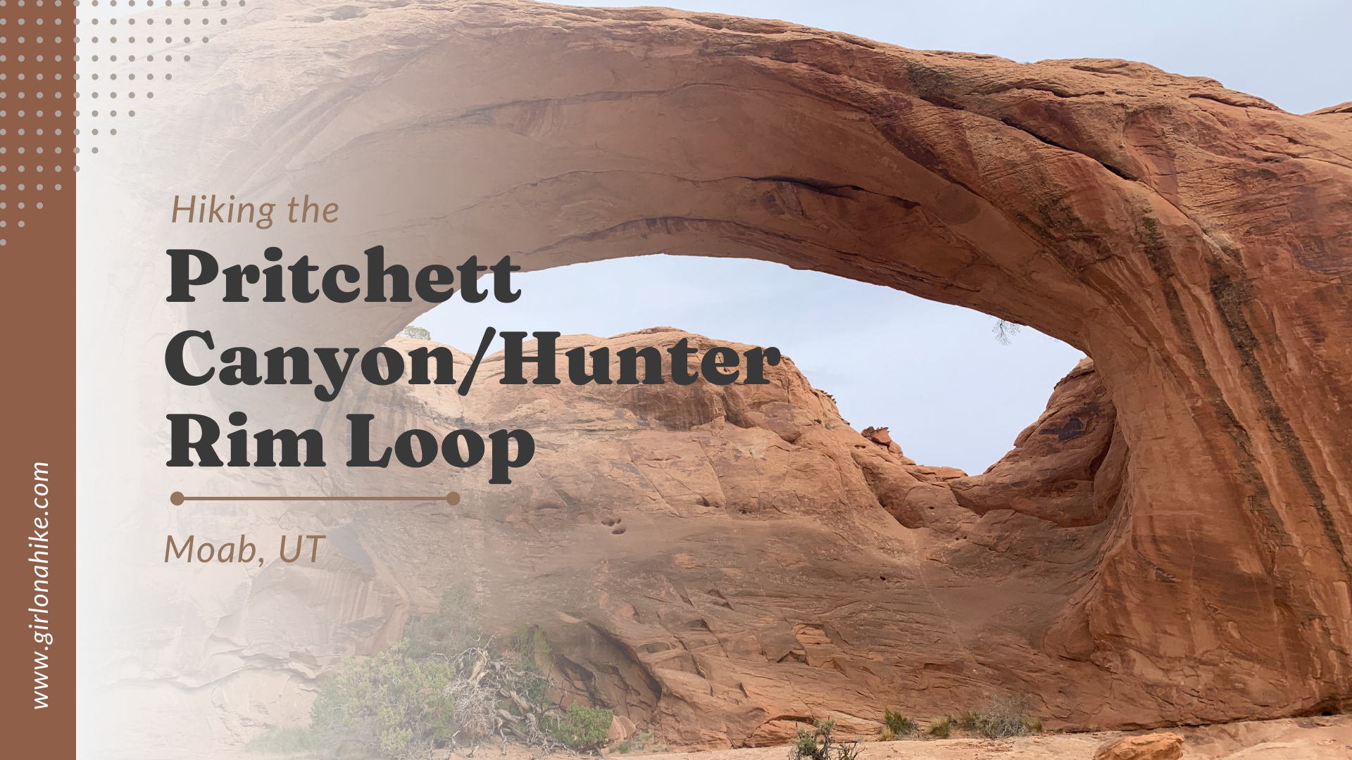
Hiking the Pritchett Canyon/Hunter Canyon Rim Loop in Moab, Utah is not only a 4x4 enthusiasts dream jeeping route, but its a great hike or trail run!
About
Pritchett Canyon & Hunter Canyon are both located just West of Moab, by about
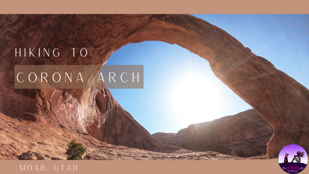
Corona Arch is one of Moab's most popular trails and one of the most impressive arches in Southern Utah. From Moab, Corona Arch is closer than that of any arch in Arches National Park, and dogs are allowed (whereas in Arches NP dogs aren't allowed to hike any trails).
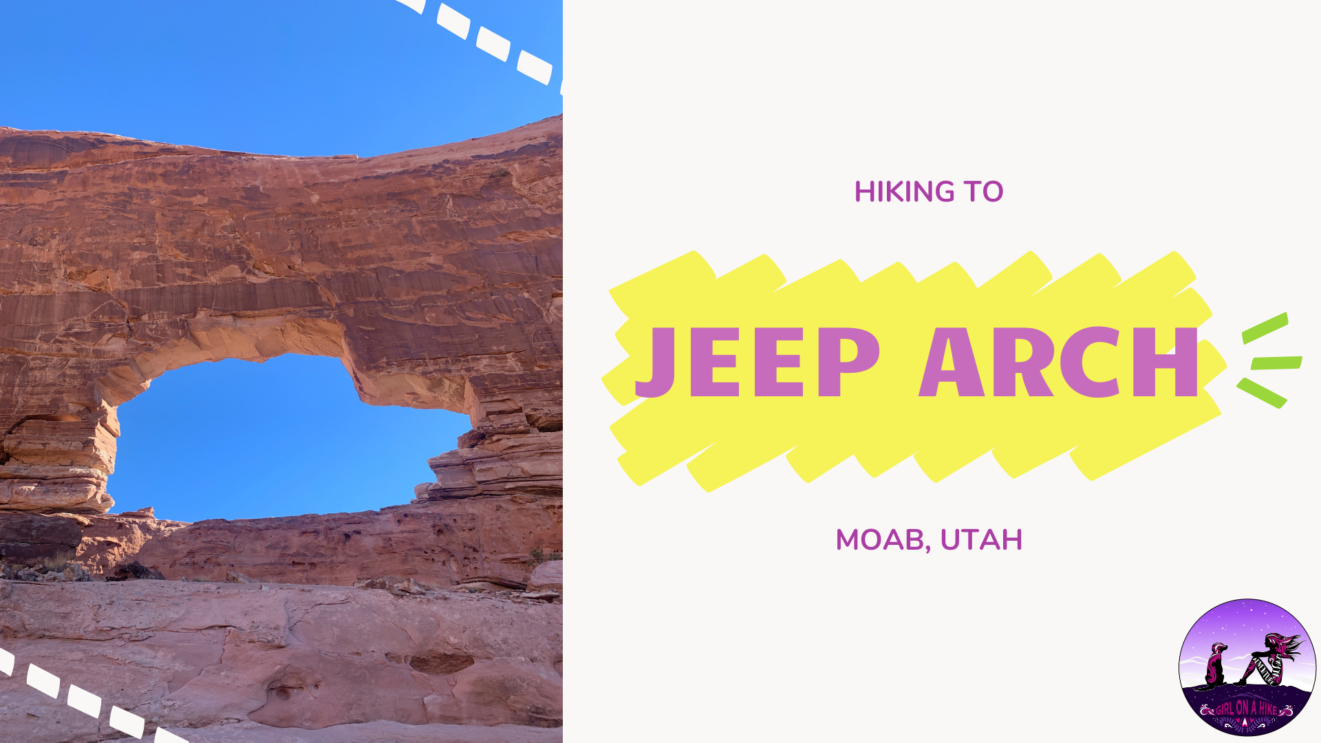
Jeep Arch, located only 15 minutes from Moab, Utah is one of the many amazing arches this area has to offer hikers. Its neighbor, Corona Arch, sees thousands of people a year yet Jeep Arch is a mere 0.3 miles down the same road and sees way less people. From it's name, you'd think it's a stop along the annual Jeep Safari routes, however no motorized vehicles (nor mountain bikes) are allowed on this trail. The arch got its name for the resemblance of a cut out of a cartoonish Jeep built into the natural sandstone.
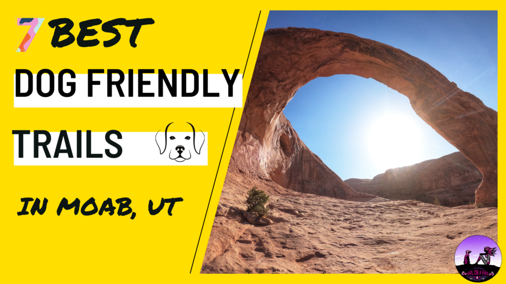
Check out the 7 Best Dog friendly trails in Moab for you and your pack! Moab, Utah is an outdoor mecca, and gateway to several National Parks and Monuments, including Arches & Canyonlands, and Dead Horse Point State Park. Many people think that because these parks aren't dog friendly, that Moab isn't dog friendly. Listen up hikers - Moab is one of THE friendliest dog towns in Utah. All you have to do is hike outside the national parks, and your pup will be in hiking heaven. There are over 20 hikes that are dog friendly and off leash - I've picked out my favorites listed below.
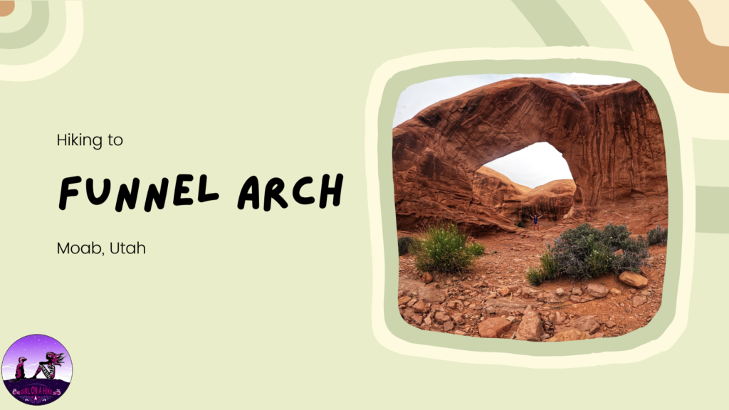
Funnel Arch (aka Cable Arch) is a short, yet rewarding hike to a massive arch located only 15 minutes from Moab, UT. Compared to the nearby Corona Arch, you'll likely see any people at this arch since it's not as well know and there's no trail sign. However, this arch is just as good, or even better, than Corona Arch. Getting to Funnel Arch does require one small section of a scramble (class 2), so I advise not bringing dogs or kids. Funnel Arch is a popular area for people to practice rappelling skills (see short video here), if you have the gear and experience.
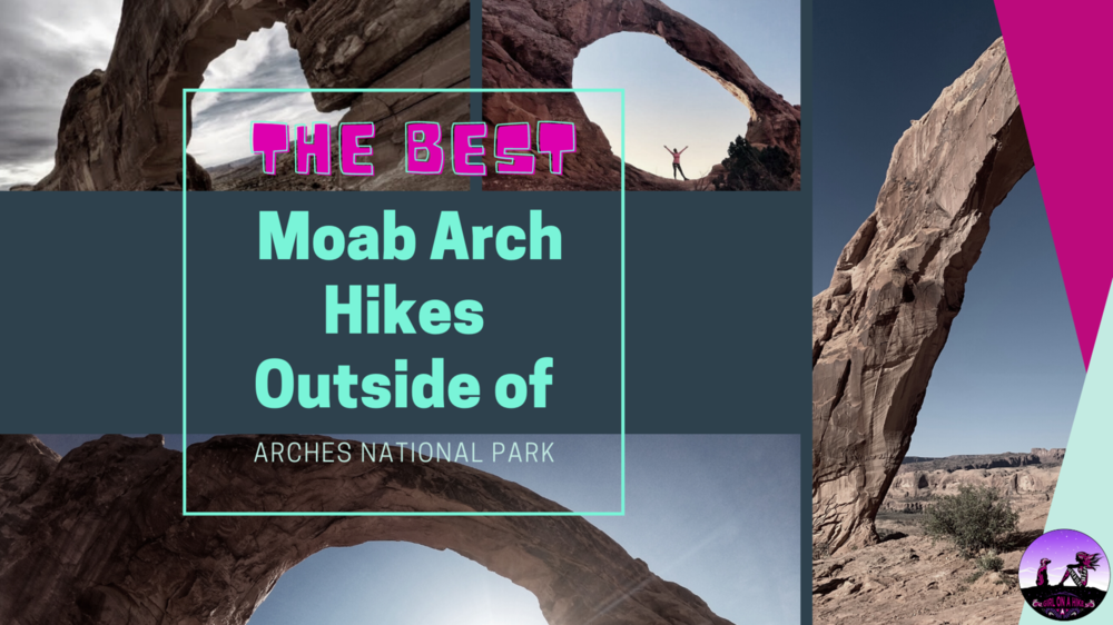
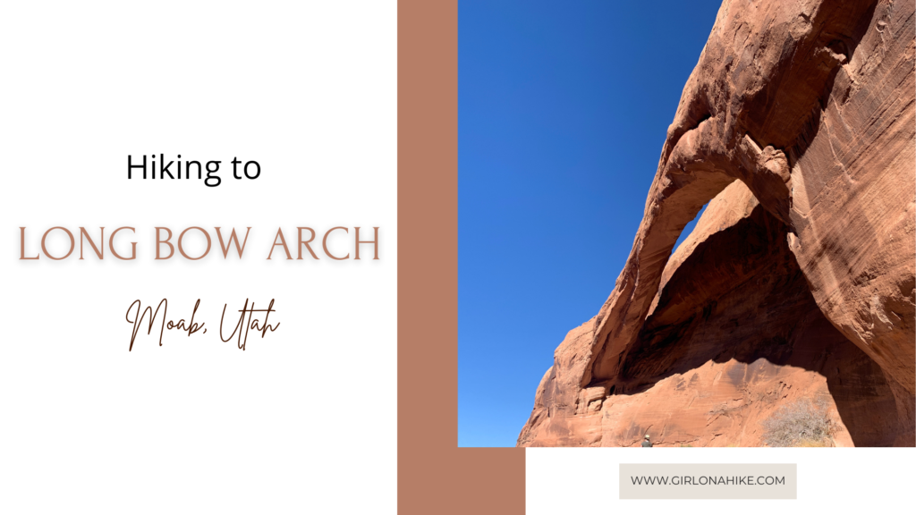
The Best Moab Arch Hikes Outside of Arches National Park are no more than a 20 minute drive from the park, plus allows dogs, and most are great for kids. These arches listed below are some of the best in the area. Why stick to just Delicate Arch when you can see something unique and off the beaten path? Check out these out to hike to something different in Moab, Utah!
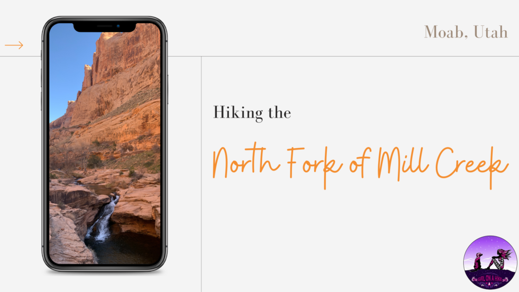
Hiking the North Fork of Mill Creek Canyon is perfect for kids, since it is only 1 mile to the first natural waterfall, and is considered the "locals swimming hole".
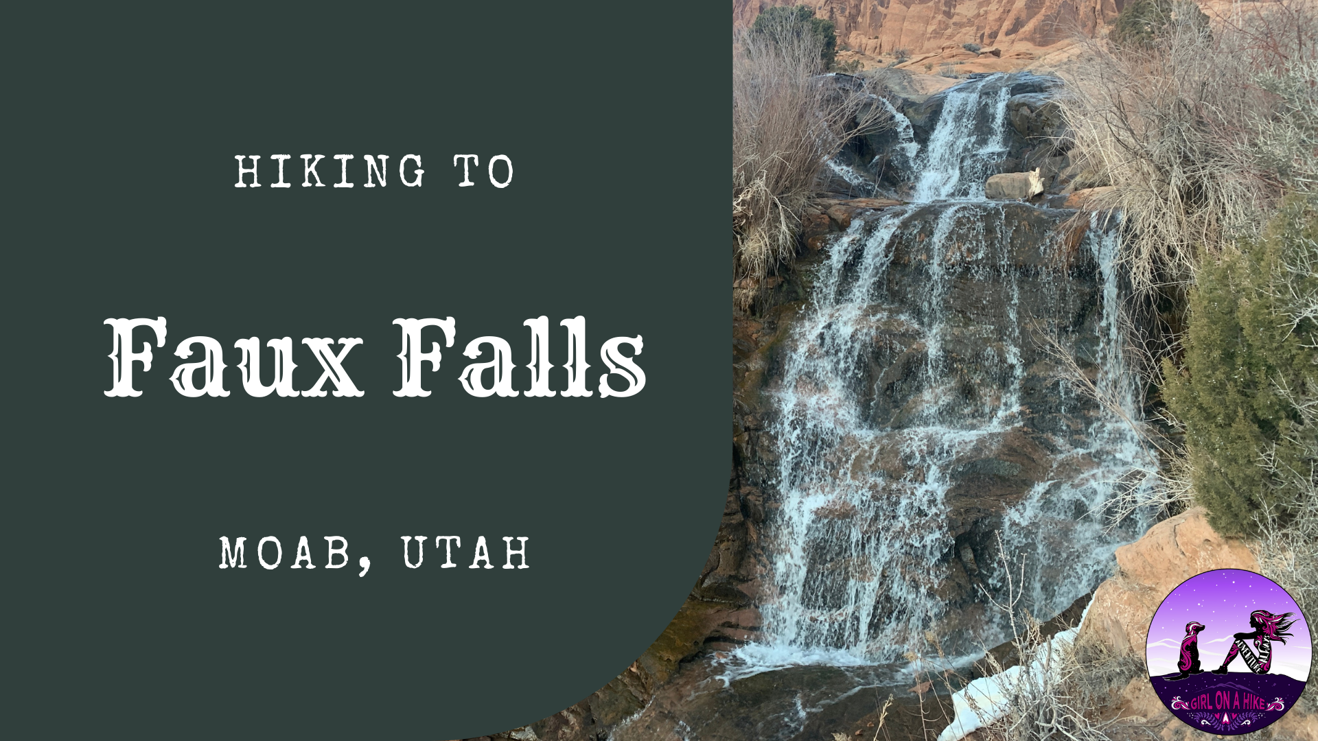
Faux Falls in Moab is a very short walk, that the whole family will enjoy. "Faux" is French for "false" or "fake", hence the name. Faux Falls was built in 1981 along with Ken's Lake, when a drought in the early 1970s pressed for the need of more water for Moab and surrounding areas. Ken's Lake is named for the then District Chairman, Ken McDonald, and the lake was dedicated for irrigation purposes in the upper Spanish Valley - long known as "Poverty Flats" because of its lack of water. It cost $4 million dollars to build the 96 ft high dam to hold an estimated 2,750 acres of water that allows for the cultivation of roughly 900 acres of land.
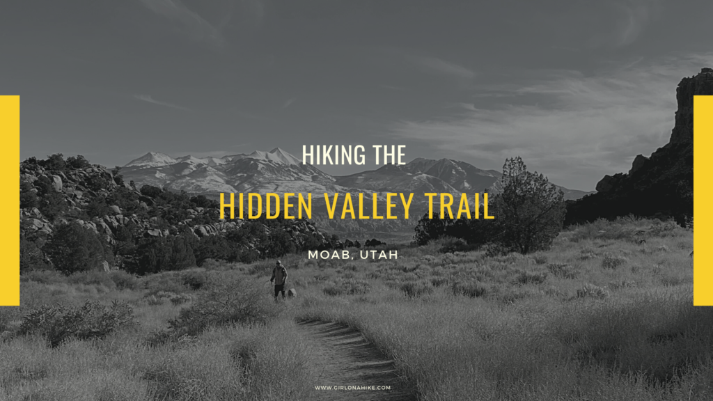
Hiking the Hidden Valley Trail right outside of Moab makes you feel like you are in a totally different place - look anywhere in Moab and the dominant sight is the Moab rim. It's known as "Behind the Rocks" - an interesting mix of sandstone fins, large rock walls, and domes. Is Hidden Valley really a valley? Not quite. It's actually two hanging terraces that descends into Behind the Rocks and eventually widens into a 4-wheel drive road while a boot-beaten path detours along the base of a sandstone wall with petroglyphs.
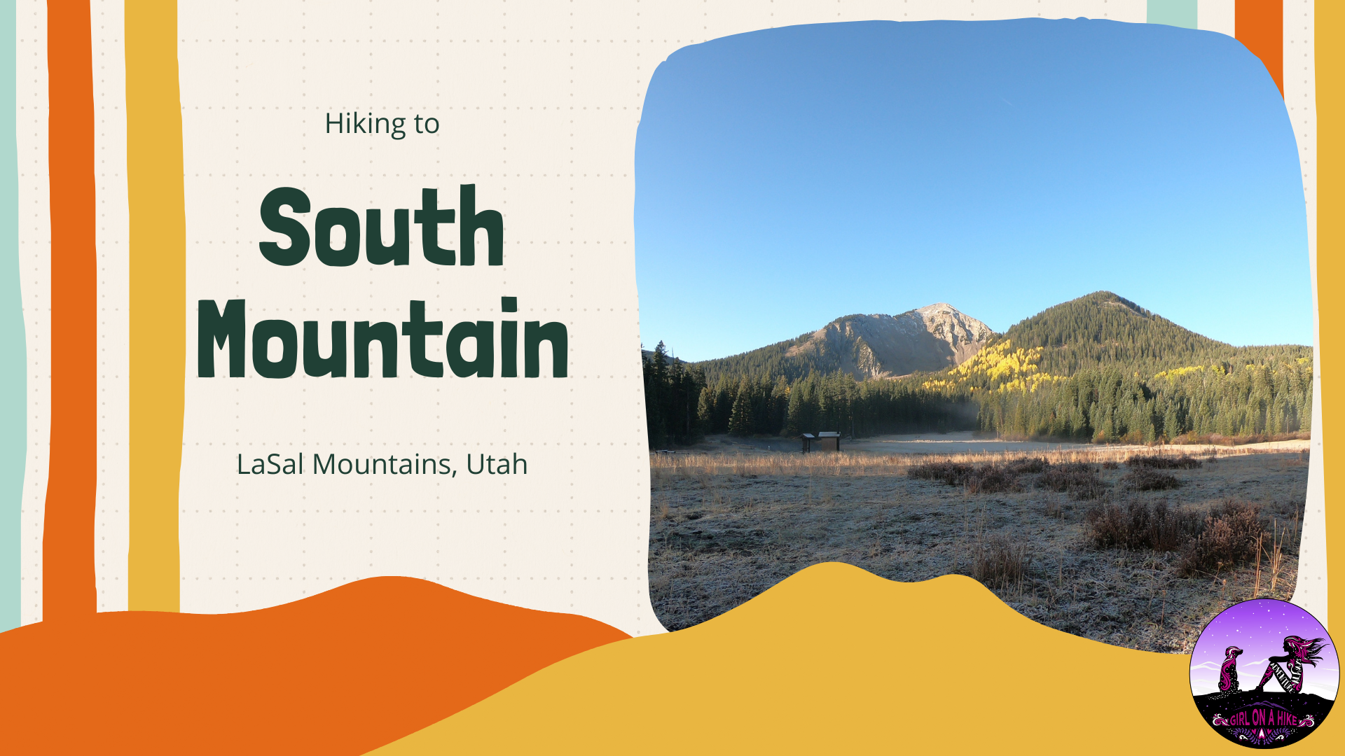
South Mountain (11,817 ft) is located on the very South end of the LaSal Mountains just outside of Moab, Utah. This is one of the easiest peaks to summit in the LaSals at only 7 miles RT. The LaSal Mountains are the 2nd highest mountain range in Utah, behind the Uinta Mountains. South Mountain is accessible by a trail half of the way, and then the second half is off trail but is easy hiking across the high alpine terrain. The trail itself is mostly exposed, with no water source. Start hiking early in the morning to beat the afternoon thunderstorms that occur almost daily in this mountain range. The best time to summit is Summer and Fall (typically late June to the first snowfall in October). Call the LaSal Ranger to make sure LaSal Pass is open before planning your hike here.
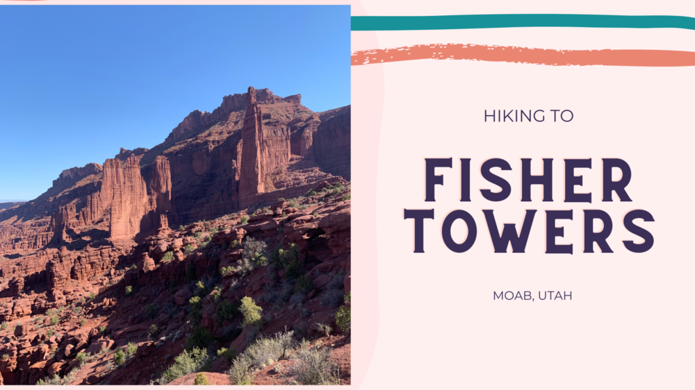
The Fisher Towers Trail is located 16 miles North East of Moab, Utah, and offers a 4 mile (RT) hike that winds through these fin-like structures. The Fisher Towers are composed of Moenkopi and Cutler sandstone, and have eroded into many shapes and sizes. These towers are one of the most outstanding scenic features of Utah's Colorado Riverway, as the rock pinnacles soar above a maze of red and pink hued canyon, and overlook the Colorado River, Onion Creek, and the famous rock "Priest & Nuns" to the south.
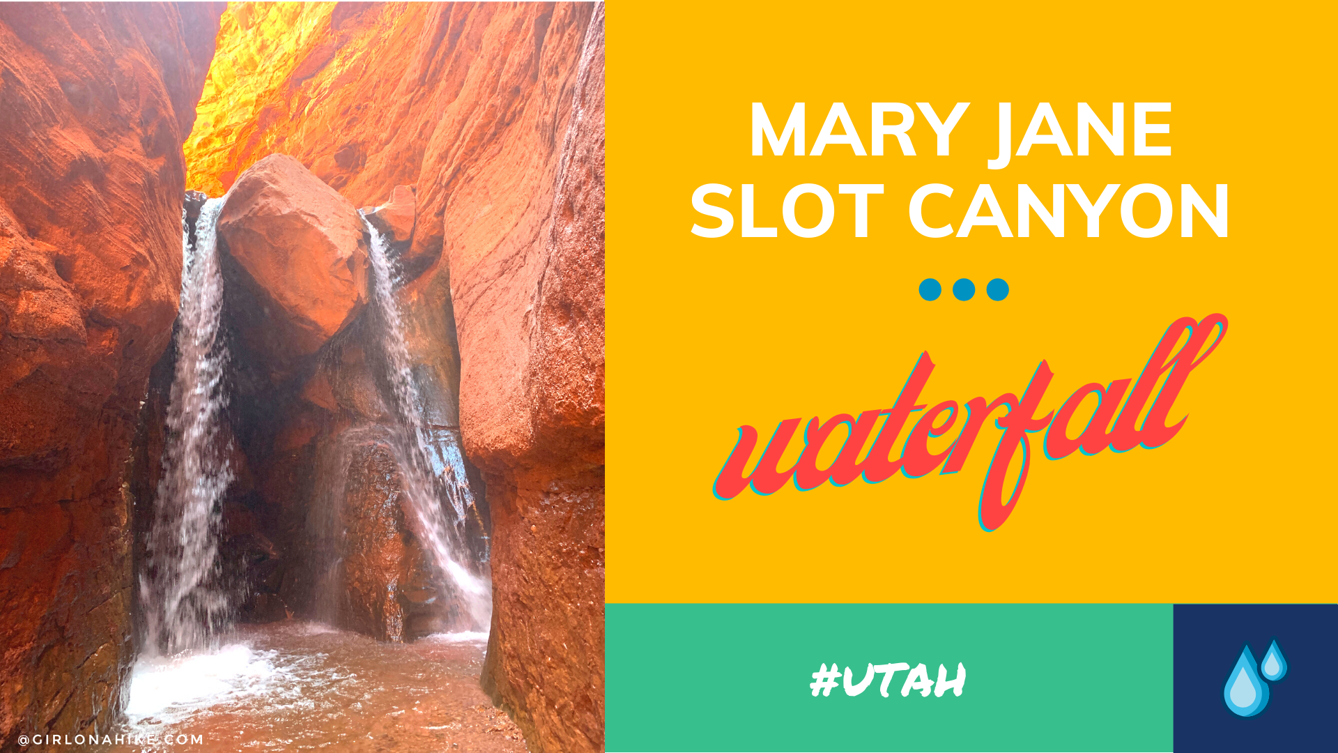
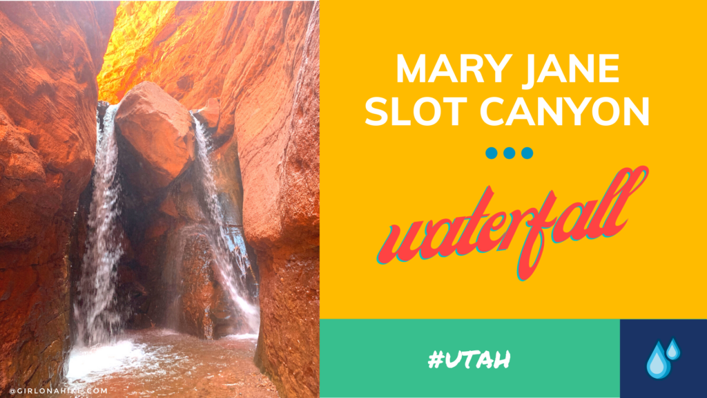
Mary Jane Slot Canyon is one of Moab's hidden gems - the "trail" is a creek the entire way, which leads to a 30 ft waterfall. This is a great trail to do when Moab is too hot, and you, the dogs, or kids need to cool off. The canyon walls get higher as you hike further into the canyon, and eventually will reach upwards of 100 ft! There are several side canyons that allow for exploring tighter slot canyons.
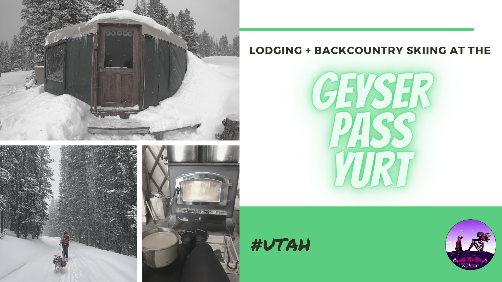
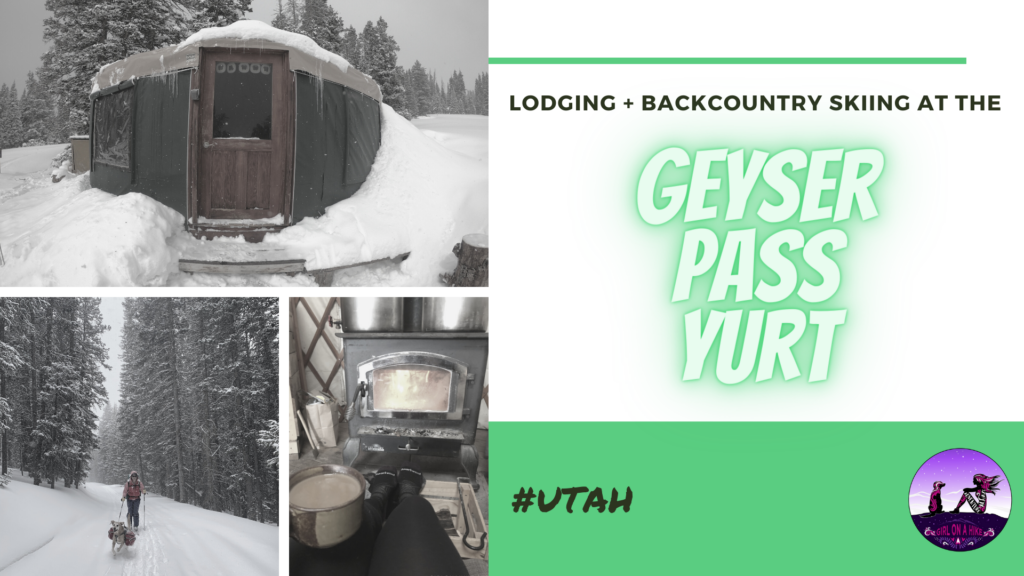
The Geyser Pass Yurt is located in the LaSal Mountains, just outside of Moab, Utah. To reach this yurt requires a 4 mile ski or snowshoe in, following the forest road that is usually drive-able in summer months. It's located right in the pass, just to the SE of Haystack Mountain and to the south ofMt.Tomasaki at 10,500 ft! While on the Manti-LaSal National Forest land, this is a privately owned yurt by Talking Mountain Yurts (TMY). They have a special permit for their yurt to be on National Forest land.
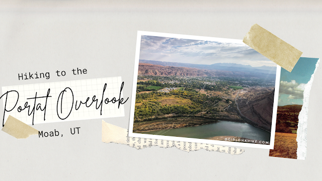
The Portal Overlook is a great overview looking down to Moab, UT as well as the LaSal Mountains and Colorado River. It's a perfect sunrise hike or good trail when you need something short with a great reward! This isn't a trail you want to do middle of summer - zero shade and water, plus lots of bikers, along with the desert heat will make this miserable and can potentially burn dogs paws. The best time to hike this is in Spring or late Fall when the temps have cooled off. Winter would be okay too, just bring microspikes. While this trail is short, I still carried 2 liters of water for just me and Charlie and we both drank it all. You'll definitely get a workout in as this climbs 800 ft to the overlook.
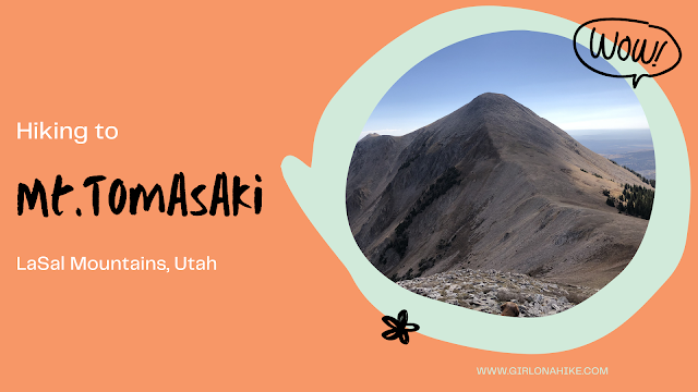
Mt.Tomasaki (12,239 ft) is a peak in the LaSal Mountains, and one of seven "12ers" in the range. The LaSal Mountains are the 2nd highest mountain range in Utah, behind the Uinta Mountains. Mt.Tomasaki is accessible by a trail half of the way from the Burro Pass TH, and then the second half is off trail but is easy hiking across the high alpine terrain. The trail itself is mostly exposed, with no water source. Start hiking early in the morning to beat the afternoon thunderstorms that occur almost daily in this mountain range. The best time to summit is Summer and Fall (typically late June to the first snowfall in October). Call the LaSal Ranger to make sure Geyser Pass is open before planning your hike here.
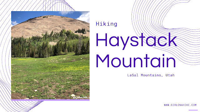
Haystack Mountain (11,641 ft) is a prominent peak in the LaSal Mountain range just outside of Moab, UT. The LaSal Mountains are the 2nd highest mountain range in Utah, behind the Uinta Mountains.
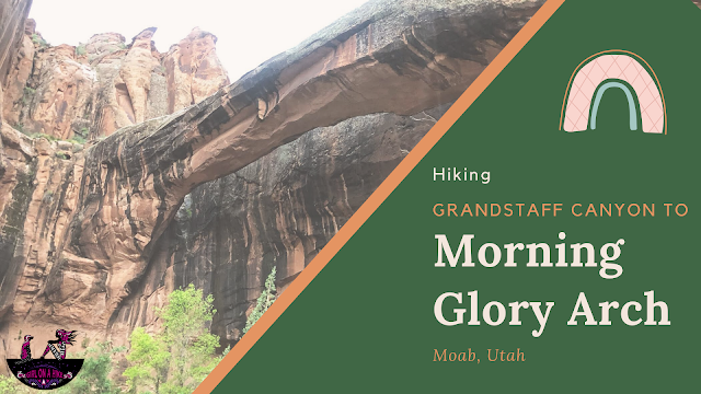
Grandstaff Canyon (previously known at Negro Bill Canyon prior to 2016) follows a perennial stream, along tall Navajo Sandstone, through an oasis of cottonwood and willow trees.
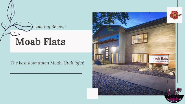
Moab Flats is Moab, Utah's best downtown lofts! Ok, that is just my opinion, but you definitely need to check this place out if you love exploring Moab, but need something dog-friendly and its just too hot (or cold) to camp.
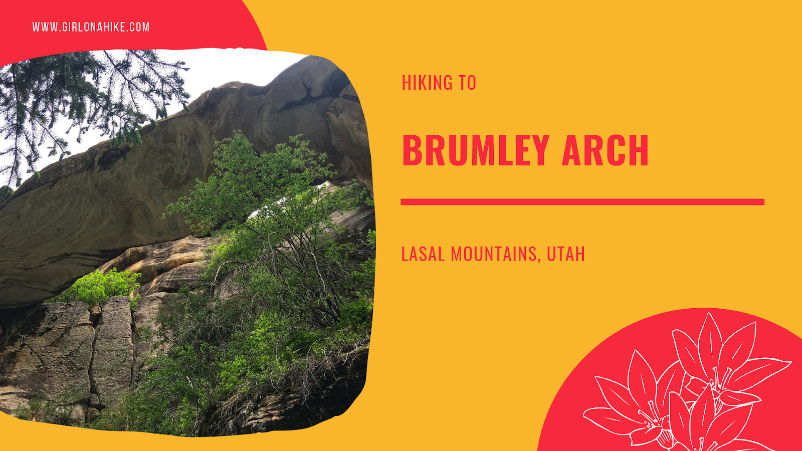
Brumley Arch is located in the LaSal Mountains, just outside Moab, Utah. It is only 2 miles round trip, making this a great family-friendly hike that even dogs are allowed to hike to. The trail is very shaded, but has some steep spots, especially to get to the bottom of the creek and to see the arch so it's best for kids over age 6. Brumley Creek runs year round, though water levels may be quite low in late Summer to Fall.
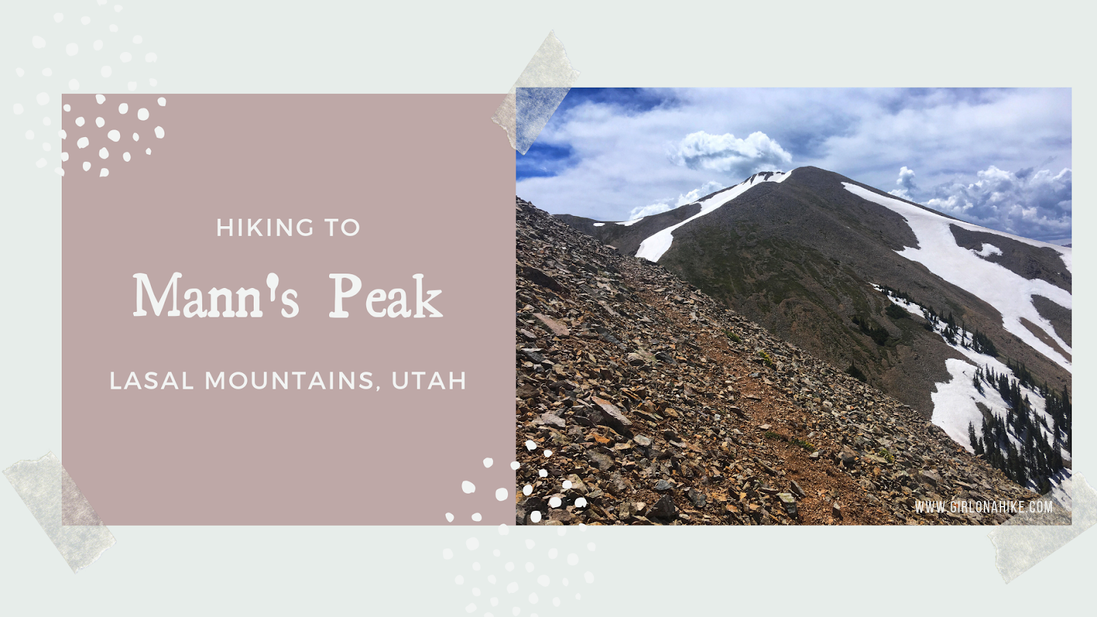
Mann's Peak (12,272 ft) 5th highest peak in the LaSal Mountains, and one of seven "12ers" in the range. The LaSal Mountains are the 2nd highest mountain range in Utah, behind the Uinta Mountains. Mann's Peak is easily accessible by a trail the entire way from the West at Warner Lake Campground, or coming from the East in Beaver Basin. The trail itself is mostly well-shaded, with plenty of water from the Dry Fork Mill Creek. As you reach the saddle, you'll hike above tree line and will be fully exposed. Start hiking early in the morning to beat the afternoon thunderstorms that occur almost daily in this mountain range. The best time to summit is Summer and Fall (typically late June to the first snowfall in October).
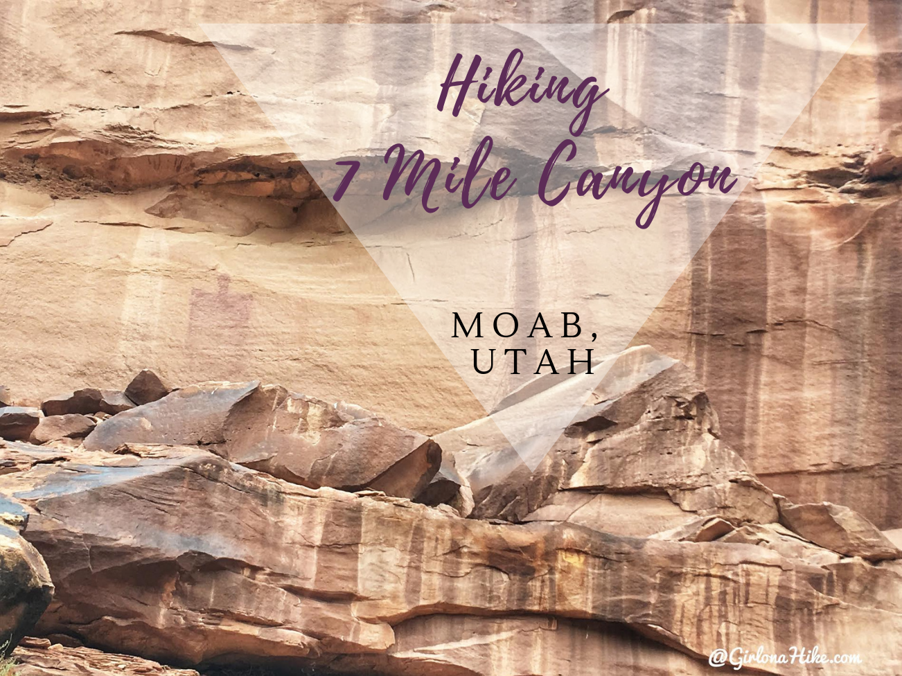
7 Mile Canyon (sometimes spelled out, Seven) is located only 11 miles North of Moab, Utah. It's a great, short hike that dogs and kids will enjoy, as it passes by several petroglphys and pictographs. The trail is very easy and flat, so no hard effort is required to get to these artifacts. 7 Mile Canyon is on the way to Dead Horse State Park, but it definitely has a quiet and remote feel. During our hike we only passed one other person. This hike is very sandy, and you'll hike in and out of the dry steam bed. There's very little shade, so be prepared with the necessary items to keep cool, and carry at least 2 liters of water (and water for your pup!). Please keep in mind that touching the artifacts are not allowed.
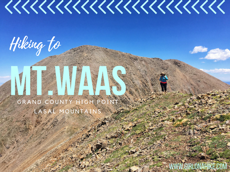
Mt. Waas (12,331 ft) is the Grand County High Point, and highest peak on the north end of the La Sal Mountains near Moab, Utah. The La Sals can be seen as far away from Green River and parts of Colorado, yet hardly anyone makes the trek to the several summits available, making a great place to seek solitude. The Moab valley can be in the 100s for daily high temperatures in the Summer, yet in the LaSals, it can be at least 20-30F cooler depending on how high you reach. The La Sals area only accessible during summer months when the gates are open, and the roads are dry and clear of snow, typically July - October. Winter of 2017 was extremely dry so we were able to summit late June 2018 with only one patch of snow.
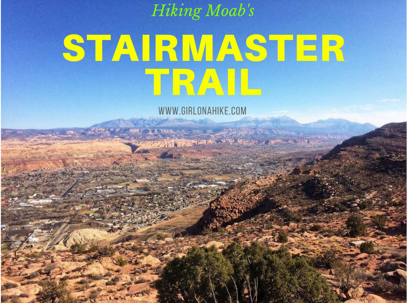
The Stair Master Trail in Moab, Utah is another short yet very rewarding hike that leads to an amazing overlook of the Moab valley and LaSal Mountains. This hike is only 1 mile to the overlook, yet it gains 820 ft. The Stair Master Trail parallels the Moab Rim Safari Jeep Route, so you are likely to see many Jeeps or Razors tackling the rock obstacles. This trail can get really hot in summer, so I recommend avoiding it in Summer months if you are hiking with your dogs (the slickrock gets too hot for their paws) OR start really early in the morning to beat the heat.
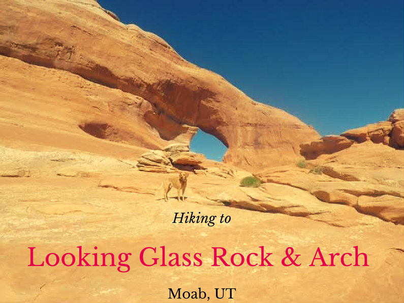
Looking Glass Rock & Arch is off HWY 191, about 25 miles south of Moab, UT yet hardly anyone makes the stop to check out this cool spot. This isn't really a "hike" but more of a "walk", since you basically drive right up to it, then walk about 200 yards up to the arch. Yet what this small walk offers is one of the best arches and viewpoints in the area. There are so many cool arches outside of Arches National Park, yet nobody cares to explore them. Best part? Dogs are allowed!
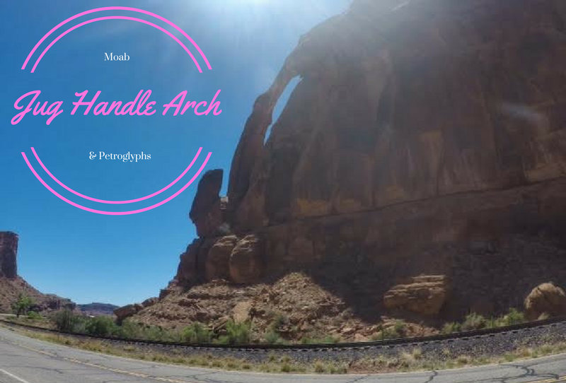
Jug Handle Arch probably ranks pretty low on the "Arches list" if there is such a thing. However, what this arch lacks in grandeur makes up for itself for a worthy stop to check out the petroglyphs along the south facing cliff wall. Don't expect much from Jug Handle Arch, but if you happen to be on HWY 191 following the Colorado River or hiked either Jeep Arch or Corona Arch it makes for a good extra, quick stop since it's only 3.5 miles past the trail heads.
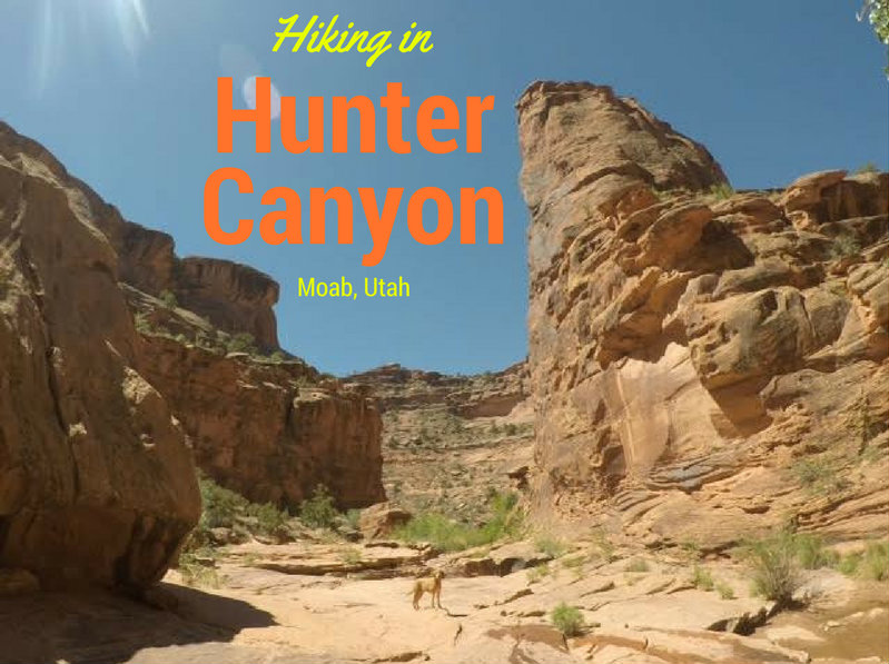
Hunter Canyon is located in Kane Creek, in the area called Behind the Rocks in Moab. Hunter Canyon is home to Hunter Arch and a few petroglyphs (if you can find them), and is a great hike for the whole family - dogs and kids, included. This winding canyon is beautiful - tall sandstone cliff walls, pools of water, a flowing stream in spring (it dries out in Summer), shade here and there to cool off, and red rock towers. Hunter Canyon stretches for miles on end, but most people turn around at the 2 mile mark, where the canyon intersects with a fork with another canyon.
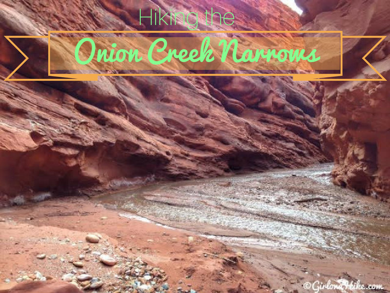
Onion Creek is located off of HWY 128 near the gorgeous Castle Valley and Fisher Towers area - both excellent for hiking and climbing. Onion Creek actually extends for roughly 22 miles, but the best section, the Onion Creek Narrows, lasts for only 1 mile. Because of the short distance, it's a great hike (really more of a walk) for the whole family - dogs will appreciate the cool relief of the creek on a hot summer day.
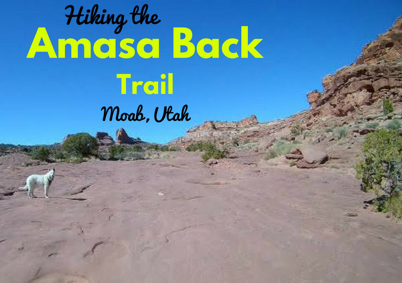
The Amasa Back Trail, like many in Utah, is an old road, more popular with mountain bikers, four-wheelers, and motorcyclists than hikers. Most people's attitude is, "Why hike when you can ride?" The easy answer is rather than being preoccupied with a machine, hiking allows you to connect with the earth directly, allows you to look up more often and take in the views, and (for me) more fulfilling than riding.
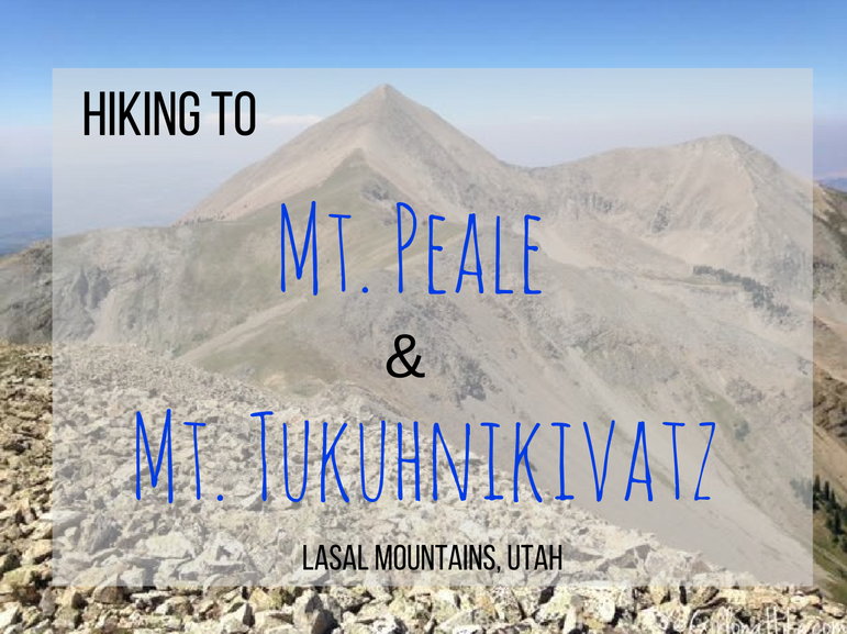
Mt. Peale (12,721 ft) and Mt. Tukuhnikivatz (12, 482 ft) are two prominent peaks in the LaSal Mountains right outside of Moab, UT. Mt. Peale is the highest point in the range, and 2nd tallest prominent mountain in Utah; Mt. Tukuhnikivatz (pronounced tuk-oon-ik-ah-vatz) is the peak you mainly see from the valley floor from Moab, and is a mountain well known in Edward Abbey's, Desert Solitaire. If you have ever lived in Utah, have passed through, or want to have some sense of what Moab and Arches National Park was like back in the day, reading Desert Solitaire is a must.
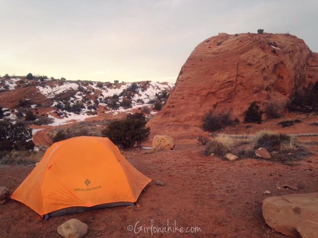
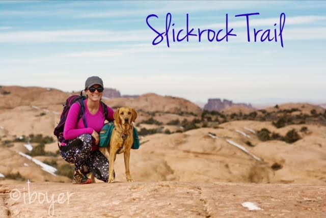
The Sand Flats Recreation Area is located just outside of Moab, UT, about 5-10 minutes to the East. Sand Flats is a nationally significant public land area at the heart of the Colorado Plateau. With high slickrock domes, bowls, and fins, it meets the colorful mesas with views of the La Sal Mountains to the East. Just to the North lies Arches National Park, and to the West, Canyonlands National Park. Sand Flats is home to one of the most famous mountain biking and hiking trails, Slickrock Trailand the nearbyGrandstaff Canyon. Sand Flats is managed through Grand County and the BLM.
Slickrock Trail, the world famous mountain biking trail, is located in Moab, Utah. Most people bike this 10.5 mile loop, but we hiked it! Slickrock Trail is located at the Sand Flats Recreation Area, about 10 minutes outside of Moab, where we also camped for two nights. This trail is popular for its scenic, rugged expanse of Navajo Sandstone, the remnant of wind blown sand dunes. Slickrock Trail was established in 1969 for motorcycles, but the trail is now popular for both mountain bikes and motorcycles - it is closed to all four-wheeled vehicles.