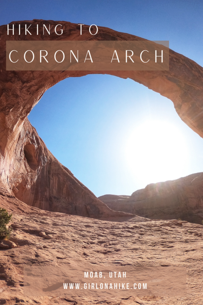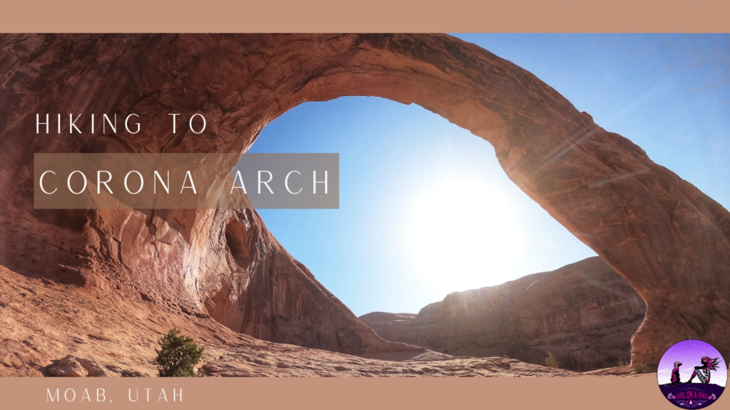
Corona Arch is one of Moab’s most popular trails and one of the most impressive arches in Southern Utah. From Moab, Corona Arch is closer than that of any arch in Arches National Park, and dogs are allowed (whereas in Arches NP dogs aren’t allowed to hike any trails).
Though this trail is extremely popular, it doesn’t see the traffic like Delicate Arch does. I believe this is simply because when people visit Moab, they only think of hiking in Arches NP, not hiking outside of the park. Yet, that’s where the best hikes are! Hiking to Corona Arch takes less than an hour for most hikers and offers beautiful views of Bootlegger Canyon.
Directions
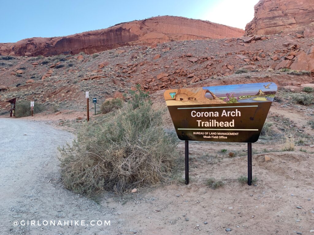
From Moab, head West on HWY 279 (Potash Road). It soon parallels the Colorado River and cuts through, what’s known as, The Portal. The drive passes by several campsites and climbing routes on the right. From the turn onto HWY 279 drive about 10 miles and look for the large brown sign for Corona Arch TH on your right. There are plenty of campsites on the left at Gold Bar, and toilets are available. Here is a driving map.
Trail Info
Distance: 3 miles RT
Elevation gain: 550 ft
Time: 1-3 hours, depending on how long you stay to enjoy the view
Dog friendly? Yes, off leash
Kid friendly? Yes!
Fees/Permits? None
I recommend arriving either really early or hiking in late afternoon to avoid the crowds. If you hike mid-week you are also likely to see way less people.
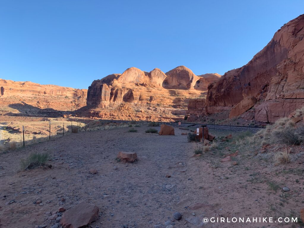
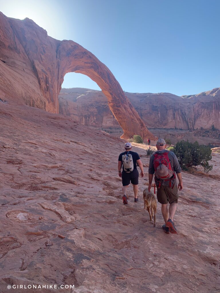
Hike up a short section, then you’ll turn left and need to cross the tracks. This is an active railroad so be careful with dogs and kids stepping on old nails and glass.
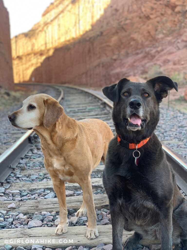
You’ll cross the train tracks that cut through Bootlegger Canyon. The train that travels this section of the canyon actually serves a purpose – it carries potash (an alkaline potassium compound, especially potassium carbonate or hydroxide) from the mine down river. Charlie and his pal Naya pose!
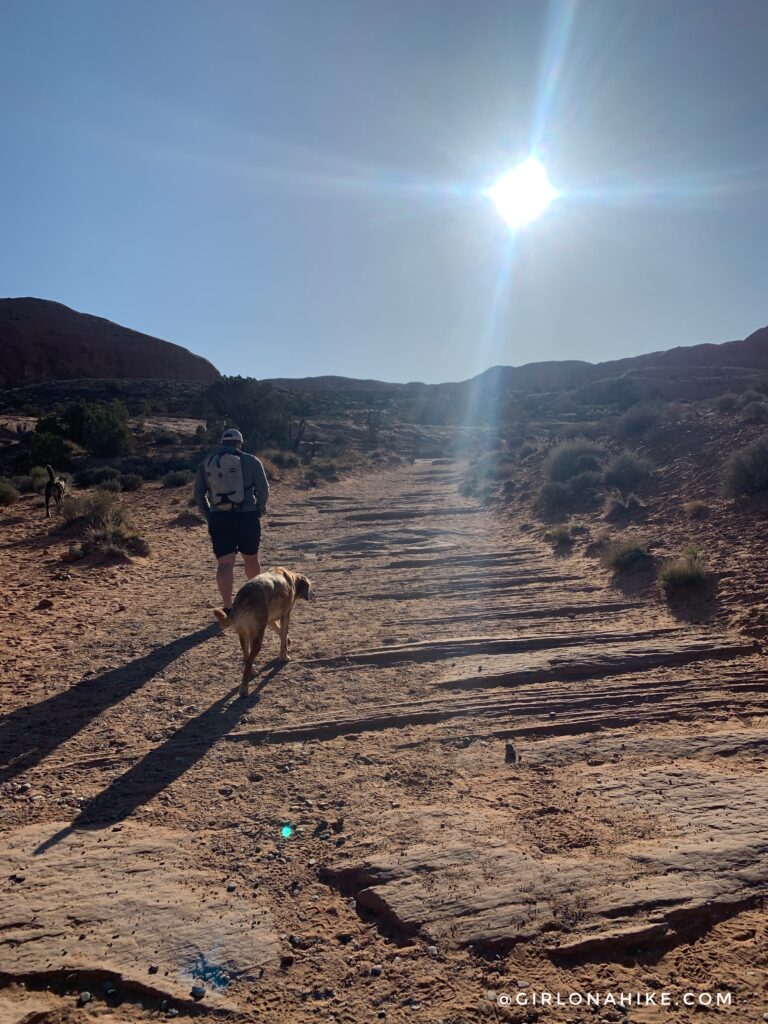
The trail heads North then wraps around a corner, heading East for a few minutes. Cairns are placed along the trail as well as green painted dots on the rock to help guide you. As long as you follow these you can’t get lost.
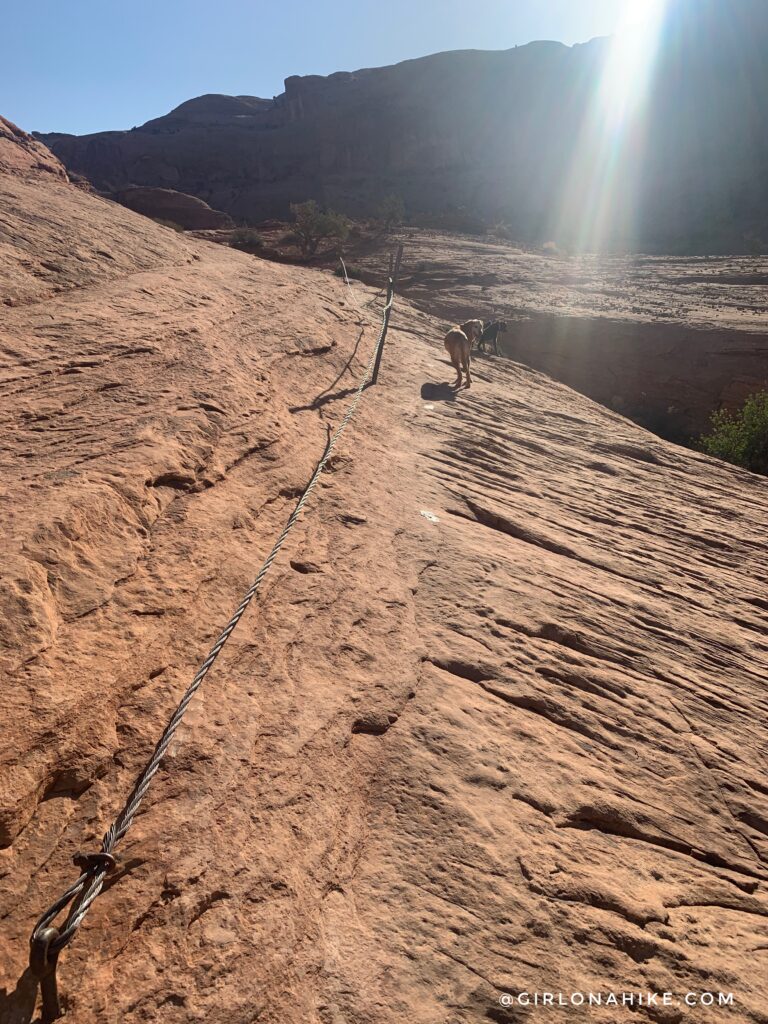
You’ll come to the first cable section, which is designed to help you walk on the slope around the corner. It’s really not needed plus it hangs too low to actually hold.
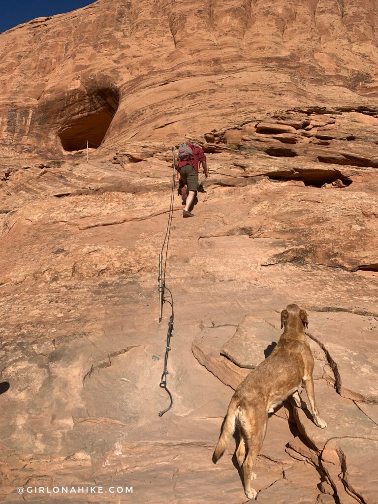
As you turn the corner after the wire rope, you should have the first view of Corona Arch! But first, hike up this cable section. Dogs can get up with a boost.
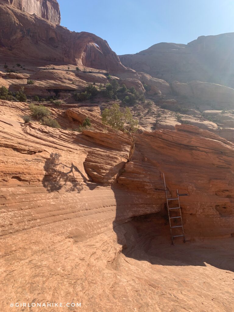
Climb up and over the first & only ladder. Dogs can easily hike up and around it from other angles with no problem.
Almost there! Start hiking early to not only beat the heat but also the crowds.
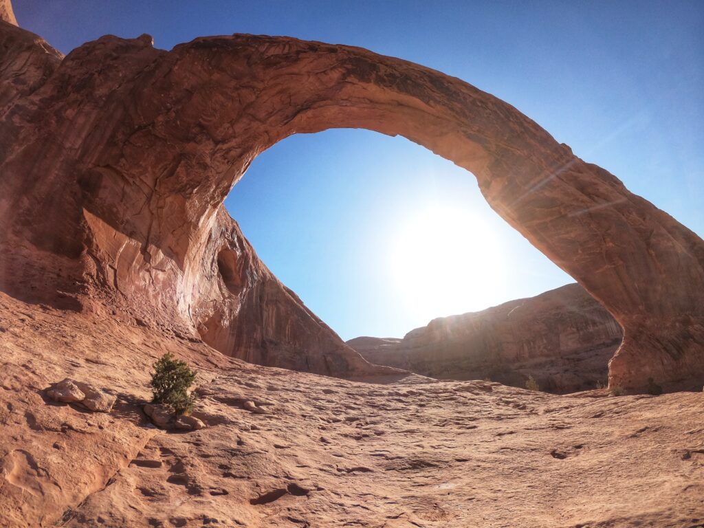
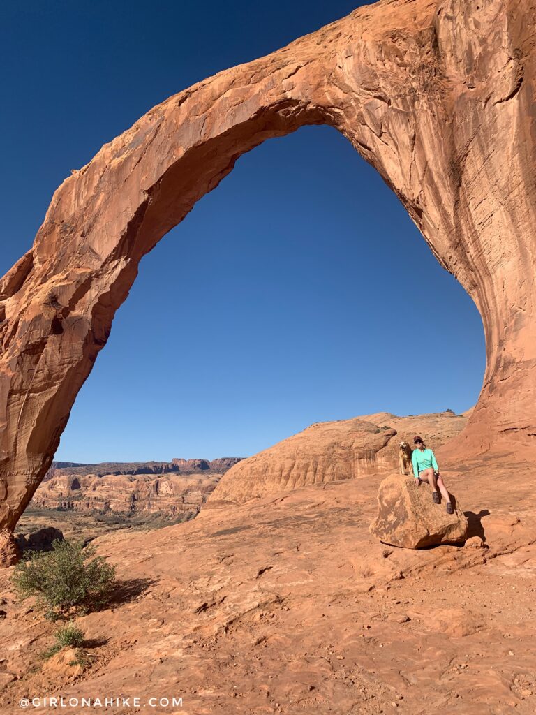
Corona Arch is quite massive – it is 105 ft high, with a span of 140 ft!
It should take fast hikers only 30-40 minutes to hike here. It’s also a great trail for kids – we saw kids from baby-age to 10, and teenagers. Older adults should also find this trail enjoyable.
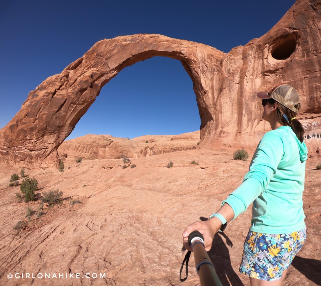
My favorite view of Corona Arch is viewed East to West. Depending on what time of day you hike, the sun should shine on either side making it look like it’s slightly glowing.
Corona Arch is the arch people used to be able to swing through – swinging, ziplining, rappelling, high-lining, and slack-lining were banned here January of 2015 due to a high number of deaths. To see an awesome video of people swinging here when it was legal, check out this video.
Trail Map
My track via Gaia GPS – the best tracking app! Get your app here for a discount.
Nearby Hike
Need a place to stay in Moab? Check out Moab Flats!


Save me on Pinterest!