

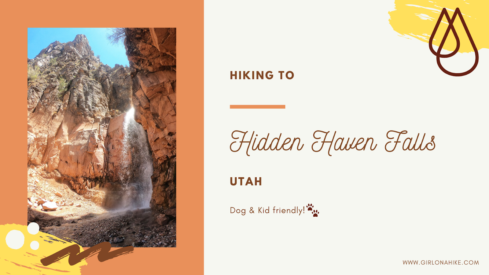
Hiking to Hidden Haven Falls is a popular hike near Parowan, Utah. This short hike is perfect for kids and dogs to hike to, especially when it's hot outside.
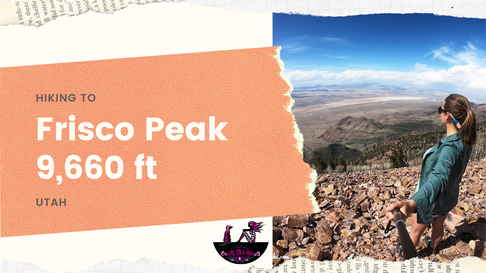

Frisco Peak (9,660 ft) is the peak above Frisco, UT and can be seen from Milford, UT. It's on the list of Utah Peaks with 25 miles of Isolation, so not many people seek out this area for hiking. m.
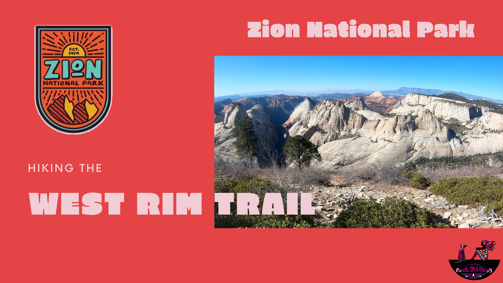
The West Rim Trail is located in Zion National Park (ZNP) and is one of several popular trails for day hikers and backpackers in the area.
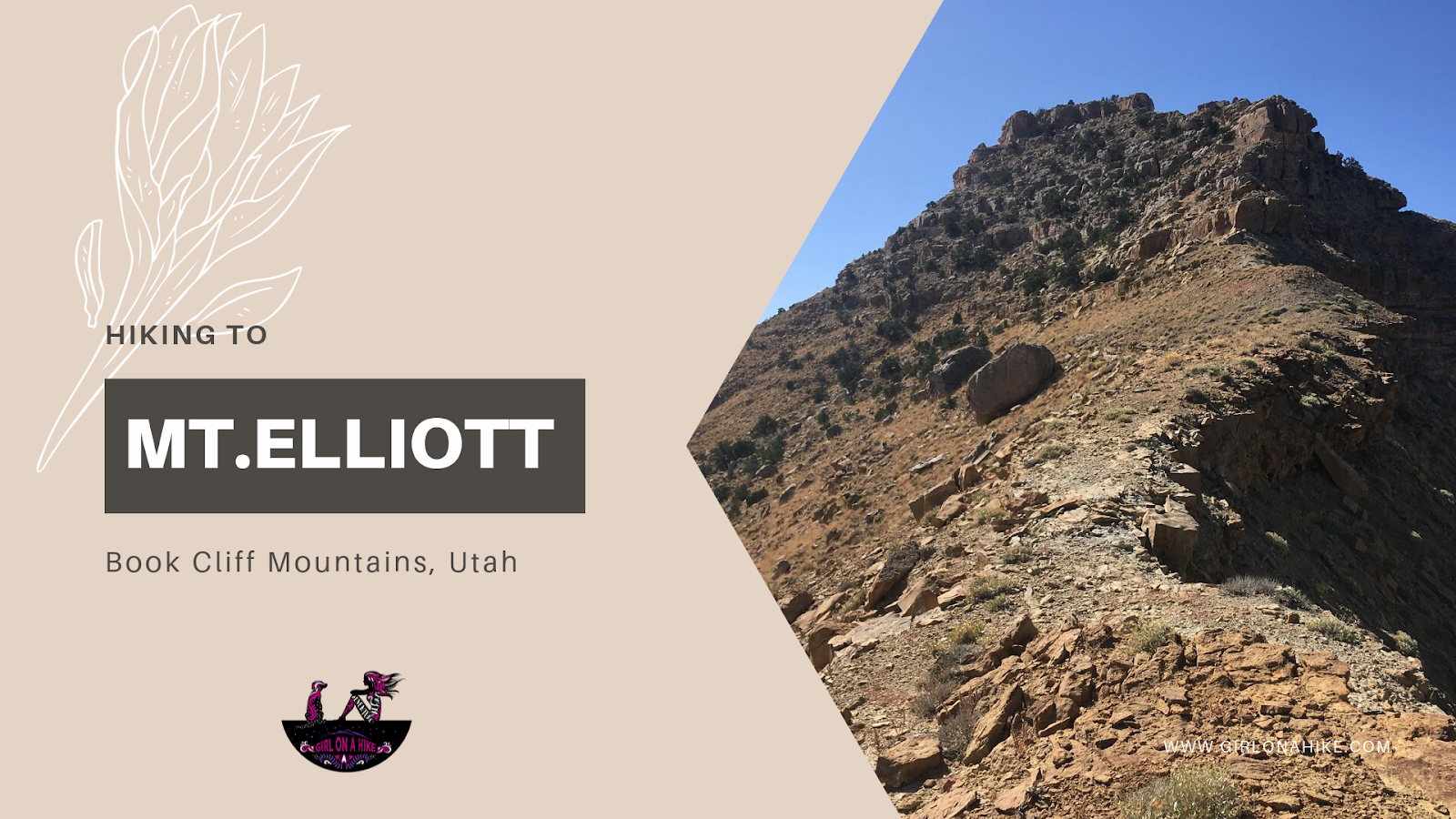
Mt.Elliott (7,142 ft) is located along the Book Cliff Mountains, in between Price, Utah and I-70. Ever driven to Moab from SLC? Then you've passed this peak and know exactly where it is! Near the town of Woodside, UT there is an abandoned gas station with people sometimes selling jerky. Look directly up and SW, and you'll see this pointy peak clearly. You can't miss it, it sticks out because of it's jagged yet isolated summit. This obscure peak ranks #24 out of 29 on the Utah Country Prominence Peak list, and because of its low popularity, only a handful of people will make it to the summit each year.
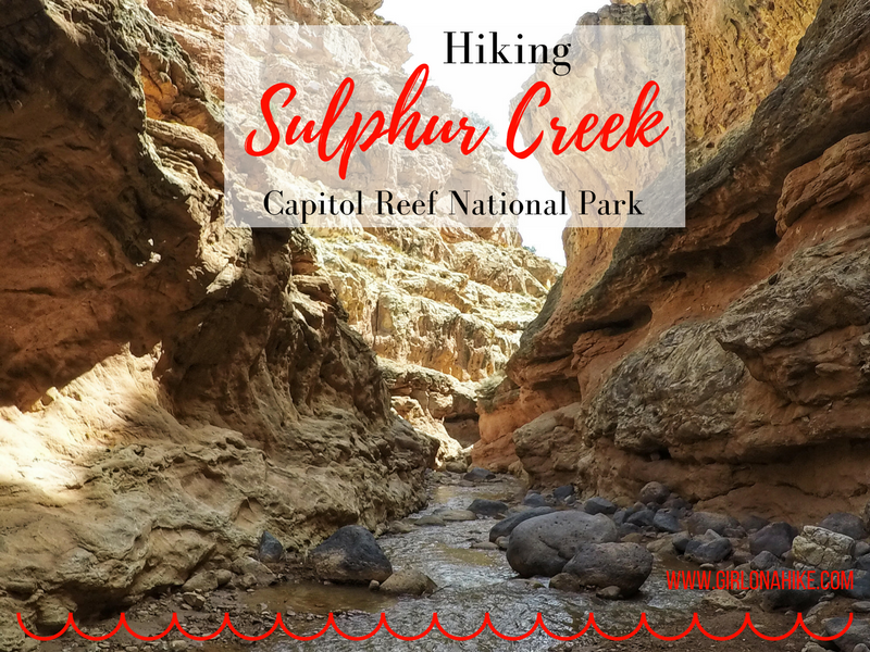
Sulphur Creek is located in Capitol Reef National Park and provides a beautiful water hike through a narrow canyon, with subway-like channels, cutting through layered, orange and red sandstone. It's considered the "Subway" or "Narrows" of CRNP, though really it lives up to its own name. The water is rarely more than ankle deep and there are three waterfalls that you can easily bypass, one forces you to slide down it's 5 foot drop!
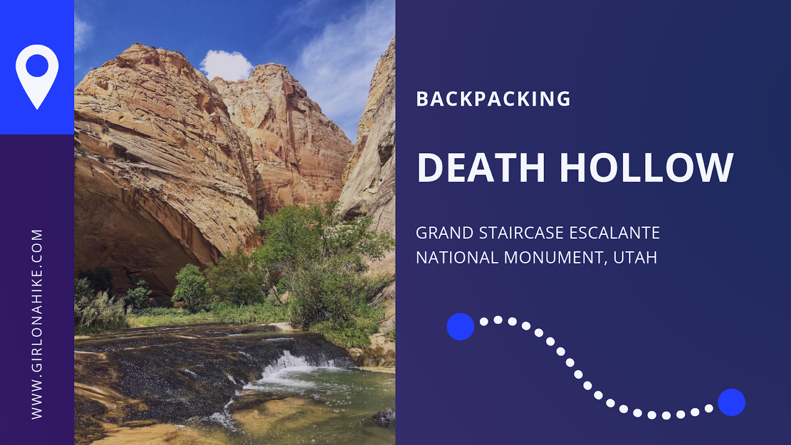
Death Hollow is located in Grand Staircase Escalante National Monument, just outside of Escalante, Utah. The first 6 miles of the trail follows the Boulder Mail Trail - the old route, that even up until 1924, the mules would carry mail on from the residents of Boulder, UT to Escalante, UT. Boulder, UT is right along Highway 12, which wasn't even paved until the 1970's, was the last area in the US to gain automobile access! No matter how much this area has changed due to technology, you'll immediately find yourself in the backcountry and won't see people for days. Over our 3 day adventure, my friend and I only saw two other people the entire time.
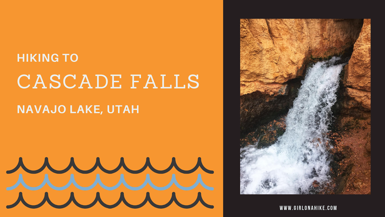
Cascade Falls is located near Navajo Lake, and is in fact, a major drainage port for the lake. The trail offers amazing view of Zion National Park on a clear day, and all ages and all types of hikers plus dogs will enjoy this area. The water from the falls is supplied by the lake through an underground lava tube (sink hole). The water flows through this for a few miles underground before exiting at the Virgin River Rim.